IMAGES TAKEN NEAR TO
Skimmingdish Lane, BICESTER, OX26 4AE

Introduction

This page details the photographs taken nearby to Skimmingdish Lane, OX26 4AE by members of the Geograph project.

The Geograph project started in 2005 with the aim of publishing, organising and preserving representative images for every square kilometre of Great Britain, Ireland and the Isle of Man.

There are currently over 7.5m images from over14,400 individuals and you can help contribute to the project by visiting https://www.geograph.org.uk

Image Map


Images are licensed for reuse under creativecommons.org/licenses/by-sa/2.0
Notes
  • Clicking on the map will re-center to the selected point.
  • The higher the marker number, the further away the image location is from the centre of the postcode.

Image Listing (17 Images Found)

Images are licensed for reuse under creativecommons.org/licenses/by-sa/2.0
Image
Details
Distance
1
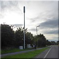
Communications mast by A4421 north of Bicester
Mast for mobile phones serving housing estates between the town centre and by-pass
Image: © David Smith Taken: 24 Aug 2017
0.05 miles
2
Skimmingdish Lane by Bicester Airfield
Image: © Steve Daniels Taken: 1 Jul 2014
0.06 miles
3
Bicester Gliding Club
This giant shed dwarfs the little planes and gliders that now use the site, but no doubt in former times it was home to something more substantial. Airfield history is at http://en.wikipedia.org/wiki/Bicester_Airfield
Image: © Des Blenkinsopp Taken: 28 Jul 2010
0.11 miles
4
Spitfire
MH434 parked (don't know if that is the correct term used by pilots) outside hangars at Bicester Airfield. MH434 was built in 1943 and is owned by Old Flying Machine Company at Duxford. Responsible for downing a number of enemy aircraft in WW2. Also had a film career in the Battle of Britain and a Bridge too Far.
Image: © Dennis simpson Taken: 5 Jul 2008
0.12 miles
5
Old Hangar
Old hangar of former RAF Bicester off Skimmingdish Lane
Image: © Shaun Ferguson Taken: 3 Jul 2019
0.13 miles
6
Coopers Green
A recent housing development near the edge of Bicester.
Image: © Bill Boaden Taken: 26 Jun 2015
0.13 miles
7
Police sign on Coopers Green
The sign says that there is a Police operation in progress. I did not see any evidence of it or find out what it was.
Image: © Bill Boaden Taken: 26 Jun 2015
0.13 miles
8
Buckingham Road, Bicester
The ring road is just visible ahead. The trees on each side are effective at screening the road from the housing estates.
Image: © Bill Boaden Taken: 26 Jun 2015
0.14 miles
9
Roundabout ahead on Buckingham Road, Bicester
The Roman road intersects the Bicester ring road.
Image: © Robin Webster Taken: 22 Aug 2020
0.15 miles
10
Bicester Heritage former RAF Bicester
Image: © Jo and Steve Turner Taken: 24 Jun 2014
0.16 miles