IMAGES TAKEN NEAR TO
Mount Pleasant Street, ASHTON-UNDER-LYNE, OL6 9HX

Introduction

This page details the photographs taken nearby to Mount Pleasant Street, OL6 9HX by members of the Geograph project.

The Geograph project started in 2005 with the aim of publishing, organising and preserving representative images for every square kilometre of Great Britain, Ireland and the Isle of Man.

There are currently over 7.5m images from over14,400 individuals and you can help contribute to the project by visiting https://www.geograph.org.uk

Image Map


Images are licensed for reuse under creativecommons.org/licenses/by-sa/2.0
Notes
  • Clicking on the map will re-center to the selected point.
  • The higher the marker number, the further away the image location is from the centre of the postcode.

Image Listing (62 Images Found)

Images are licensed for reuse under creativecommons.org/licenses/by-sa/2.0
  • ...
Image
Details
Distance
1
Canterbury Street, Ashton-Under-Lyne
The Canterbury Arms is no more, it is now a convenience store
Image: © Alexander P Kapp Taken: 20 Nov 2012
0.07 miles
2
Impregnation Services Ltd, Cowhill Lane, Ashton-Under-Lyne
An engineering firm
Image: © Alexander P Kapp Taken: 20 Nov 2012
0.09 miles
3
St James C of E Primary School
On Romney Street.
Image: © Gerald England Taken: 10 May 2012
0.10 miles
4
St James Church, Ashton-Under-Lyne
Image: © Alexander P Kapp Taken: 20 Nov 2012
0.10 miles
5
St James Church, Ashton-Under-Lyne
Image: © Alexander P Kapp Taken: 20 Nov 2012
0.10 miles
6
St James Church, Ashton-Under-Lyne, Nameboard
Image: © Alexander P Kapp Taken: 20 Nov 2012
0.11 miles
7
Romney Street Bridge
The bridge over the Stalybridge to Manchester Victoria railway line is now for pedestrians only. The section from the bridge to Penny Meadow has been utilised for the construction of the Northern Relief Road Image
Image: © Gerald England Taken: 10 May 2012
0.15 miles
8
From Romney Street bridge
Looking over the litter-strewn cutting carrying the Stalybridge to Manchester Victoria railway line under Cowhill Lane bridge. On the left is the new Northern Relief Road Image and the offices of Tameside Metropolitan Borough Council. The blue building in the background is the Manchester IKEA store.
Image: © Gerald England Taken: 10 May 2012
0.15 miles
9
Ashton under Lyne
Train leaving Ashton under Lyne station.
Image: © Peter McDermott Taken: 29 Aug 2015
0.15 miles
10
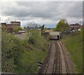
Stalybridge to Victoria line
The railway line from Stalybridge to Manchester Victoria from the Romney Street bridge. The next bridge in view is Cowhill Lane.
Image: © Gerald England Taken: 19 Nov 2009
0.16 miles
  • ...