IMAGES TAKEN NEAR TO
Holl Lane, DEREHAM, NR20 4RQ

Introduction

This page details the photographs taken nearby to Holl Lane, NR20 4RQ by members of the Geograph project.

The Geograph project started in 2005 with the aim of publishing, organising and preserving representative images for every square kilometre of Great Britain, Ireland and the Isle of Man.

There are currently over 7.5m images from over14,400 individuals and you can help contribute to the project by visiting https://www.geograph.org.uk

Image Map


Images are licensed for reuse under creativecommons.org/licenses/by-sa/2.0
Notes
  • Clicking on the map will re-center to the selected point.
  • The higher the marker number, the further away the image location is from the centre of the postcode.

Image Listing (12 Images Found)

Images are licensed for reuse under creativecommons.org/licenses/by-sa/2.0
Image
Details
Distance
1
Fenced off building near Billingford
Image: © Hugh Venables Taken: 17 Apr 2016
0.00 miles
2
Stream and garden, Billingford
Image: © Hugh Venables Taken: 17 Apr 2016
0.08 miles
3
Holl Lane, Billingford
Image: © David Smith Taken: 12 Jun 2024
0.16 miles
4
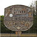
Billingford village sign
Only traces of the colours remain but the sign still gives the same message despite its drab appearance. The church of St Peter is prominent, top centre with village cricket and football clubs recognised. A Roman helmet tells of the Roman settlement just outside the village centre. The River Wensum is represented by the blue discernable below the church. The wheat-sheaf is symbolic of the agricultural heritage of the parish. Below the name is a motto which translated means “The prudent man is patient”. It is a reference to the Lord of the Manor which was purchased from Thomas Curson of Bylaugh in 1606 by Sir Edward Coke, Earl of Leicester, of Holkham Hall. https://www.geograph.org.uk/photo/6796358
Image: © Adrian S Pye Taken: 3 Apr 2021
0.19 miles
5
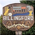
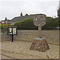
Billingford St Peter's village sign, repainted
The church of St Peter is prominent, top centre with village cricket and football clubs recognised. A Roman helmet tells of the Roman settlement just outside the village centre. The River Wensum is represented by the blue below the church. The wheat-sheaf is symbolic of the agricultural heritage of the parish. Below the name is a motto which translated means “The prudent man is patient”. It is a reference to the Lord of the Manor which was purchased from Thomas Curson of Bylaugh in 1606 by Sir Edward Coke, Earl of Leicester, of Holkham Hall.
Image: © Jane Rackham Taken: 3 Jun 2022
0.19 miles
6
Slad Lane
Hedgerows and hedgerow trees on Slad Lane
Image: © P Gaskell Taken: Unknown
0.19 miles
7
Holl Lane
Junction of Holl Lane and The Street
Image: © P Gaskell Taken: Unknown
0.19 miles
8
Billingford village sign
Only traces of the colours remain but the sign still gives the same message despite its drab appearance. The church of St Peter is prominent, top centre with village cricket and football clubs recognised. A Roman helmet tells of the Roman settlement just outside the village centre. The River Wensum is represented by the blue discernable below the church. The wheat-sheaf is symbolic of the agricultural heritage of the parish. Below the name is a motto which translated means “The prudent man is patient”. It is a reference to the Lord of the Manor which was purchased from Thomas Curson of Bylaugh in 1606 by Sir Edward Coke, Earl of Leicester, of Holkham Hall. https://www.geograph.org.uk/photo/6796355
Image: © Adrian S Pye Taken: 3 Apr 2021
0.19 miles
9
The Street, Billingford
View from junction with Church Lane.
Image: © Evelyn Simak Taken: 4 Oct 2007
0.20 miles
10
Slad Lane
Image: © Hugh Venables Taken: 17 Apr 2016
0.23 miles