IMAGES TAKEN NEAR TO
Carrs Road, NORWICH, NR13 4HL

Introduction

This page details the photographs taken nearby to Carrs Road, NR13 4HL by members of the Geograph project.

The Geograph project started in 2005 with the aim of publishing, organising and preserving representative images for every square kilometre of Great Britain, Ireland and the Isle of Man.

There are currently over 7.5m images from over14,400 individuals and you can help contribute to the project by visiting https://www.geograph.org.uk

Image Map


Images are licensed for reuse under creativecommons.org/licenses/by-sa/2.0
Notes
  • Clicking on the map will re-center to the selected point.
  • The higher the marker number, the further away the image location is from the centre of the postcode.

Image Listing (21 Images Found)

Images are licensed for reuse under creativecommons.org/licenses/by-sa/2.0
  • ...
Image
Details
Distance
1
The village hall in Hassingham
Image: © Evelyn Simak Taken: 16 Jan 2011
0.04 miles
2
Meadow south of Hassingham village hall
It presumably serves as the car park for the village hall > http://www.geograph.org.uk/photo/2234883 which is situated in the adjoining grid square.
Image: © Evelyn Simak Taken: 16 Jan 2011
0.04 miles
3
Buckenham: Property on the corner of School Road and Carrs Road
Image: © Michael Garlick Taken: 9 Jun 2022
0.05 miles
4
Buckenham: The Old School
Image: © Michael Garlick Taken: 9 Jun 2022
0.05 miles
5
To Hassingham on Carrs Road
Image: © Evelyn Simak Taken: 16 Jan 2011
0.12 miles
6
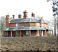
The Old Rectory
The Old Rectory retains some traces of a C17 house but the present red-brick house was built for the Rev T.W. Beauchamp in 1827 and extended in 1839. The chimney stacks have clustered octagonal and diagonal shafts and are dated "TPB 1827" > http://www.geograph.org.uk/photo/4891636. The interior of the building, which is Grade II listed, contains many re-set archaeological fragments collected by Reverend Beauchamp. The adjoining stable block and coach house are also Grade II listed. The surrounding red-brick wall has a rare wayside pulpit > http://www.geograph.org.uk/photo/861877 which was put in for the Rev. William Haslam, who was rector here from 1863 to 1871; he used this pulpit to preach to the huge crowds that gathered in the adjoining field > http://www.geograph.org.uk/photo/861882.
Image: © Evelyn Simak Taken: 3 Apr 2016
0.19 miles
7
Rev. William Haslam's wayside pulpit
In brick wall surrounding the Old Rectory. The Old Rectory retains some traces of a C17 house but the present red-brick house was built for the Rev T.W. Beauchamp in 1827 and extended in 1839. The surrounding red-brick wall has a wayside pulpit which was put in for the Rev. William Haslam, who was rector here from 1863 to 1871; he used this pulpit to preach to the huge crowds that gathered in the adjoining field > http://www.geograph.org.uk/photo/861882.
Image: © Evelyn Simak Taken: 11 Jul 2007
0.19 miles
8
The Old Rectory
The Old Rectory retains some traces of a C17 house but the present red-brick house was built for the Rev T.W. Beauchamp in 1827 and extended in 1839. The surrounding red-brick wall has a wayside pulpit > http://www.geograph.org.uk/photo/861877 which was put in for the Rev. William Haslam, who was rector here from 1863 to 1871; he used this pulpit to preach to the huge crowds that gathered in the adjoining field > http://www.geograph.org.uk/photo/861882.
Image: © Evelyn Simak Taken: 11 Jul 2007
0.20 miles
9
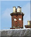
The Old Rectory (detail)
For a full view of this building see > http://www.geograph.org.uk/photo/4891625.
Image: © Evelyn Simak Taken: 3 Apr 2016
0.20 miles
10
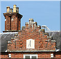
The Old Rectory (detail)
For a full view of this building see > http://www.geograph.org.uk/photo/4891625.
Image: © Evelyn Simak Taken: 3 Apr 2016
0.20 miles
  • ...