1
Looking south from high ground, Upper Coedcae
The view south from ground at about 430 metres (1410 feet) above sea level.
The view
north http://www.geograph.org.uk/photo/2134745
west http://www.geograph.org.uk/photo/2134755
east http://www.geograph.org.uk/photo/2134768
from the same spot.
Image: © Jaggery
Taken: 25 Oct 2010
0.03 miles
2
Llanover Road Estate, Blaenavon
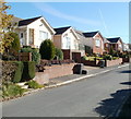
Bungalows on Llanover Road Estate, a small area of housing along two parallel roads on the west side of Giles Road.
Image: © Jaggery
Taken: 25 Oct 2010
0.08 miles
3
The Pottery, Blaenavon
Pub on Llanover Road, viewed from Giles Road. Attractions advertised on boards on the wall include bar food; real ales; beer garden; pool&darts; big screen TV.
Image: © Jaggery
Taken: 25 Oct 2010
0.09 miles
4
Track descends towards Upper Coedcae Road, Blaenavon
The view from high ground along a rough track between low stone walls towards the eastern end of Upper Coedcae Road.
Image: © Jaggery
Taken: 25 Oct 2010
0.09 miles
5
Llanover Road houses, Blaenavon
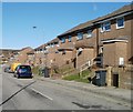
Houses on the north side of Llanover Road.
Image: © Jaggery
Taken: 25 Oct 2010
0.10 miles
6
Giles Road, Blaenavon
Giles Road is in the highest (NE) part of Blaenavon. The street level here is about 390 metres (1280 feet) above sea level. Double yellow lines on both sides indicate no parking at any time.
Image: © Jaggery
Taken: 23 Sep 2015
0.11 miles
7
Giles Road, Blaenavon
Houses on the NE side of Giles Road, in the highest (NE) section of Blaenavon.
The street level here is about 390 metres (1280 feet) above sea level.
Image: © Jaggery
Taken: 25 Oct 2010
0.12 miles
8
Two houses at the SE edge of Upper Coedcae Road, Blaenavon
Two semi-detached houses viewed from the edge of moorland at the eastern boundary of residential Blaenavon.
Image: © Jaggery
Taken: 25 Oct 2010
0.12 miles
9
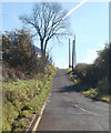
Blaenavon : Upper Coedcae Road narrows to single track
Beyond the turning for Giles Road (lower right corner), the eastern end of Upper Coedcae Road is single track, at the eastern edge of residential Blaenavon.
Image: © Jaggery
Taken: 25 Oct 2010
0.12 miles
10
Llanover Road, Blaenavon
Looking WNW down Llanover Road. Note the extensive patchwork of road works and repairs.
Image: © David P Howard
Taken: 13 Apr 2012
0.13 miles


