1
Down The Highway, New Inn
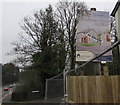
The Highway descends from Usk Road towards the centre of New Inn.
Ahead for Pontypool & New Inn railway station. https://www.geograph.org.uk/photo/1762577
Image: © Jaggery
Taken: 11 Apr 2018
0.01 miles
2
Only One Remaining, New Inn
The sign on the corner of The Highway and Lodge Wood is at the edge of newly-built houses on April 11th 2018.
Image: © Jaggery
Taken: 11 Apr 2018
0.02 miles
3
Recently-built houses on a New Inn corner
On April 11th 2018 temporary fencing encloses new houses on the corner of Lodge Wood and The Highway.
Image: © Jaggery
Taken: 11 Apr 2018
0.02 miles
4
Northwest end of The Highway, New Inn
The Highway, the main road through New Inn, ends here at the Usk Road junction.
Image: © Jaggery
Taken: 11 Apr 2018
0.03 miles
5
Up The Highway, New Inn
The main road through New Inn, The Highway ascends towards the Usk Road junction.
Image: © Jaggery
Taken: 11 Apr 2018
0.03 miles
6
Monmouthshire & Brecon Canal, New Inn
The towpath is being resurfaced along this stretch.
Image: © John Lord
Taken: 2 Mar 2011
0.03 miles
7
Bridge 53, Monmouthshire & Brecon Canal
Looking downstream, the bridge carries The Highway. The tow path is part of National Cycle Route 49.
Image: © M J Roscoe
Taken: 26 Jul 2018
0.03 miles
8
Reflections on the Mon & Brec, New Inn
Looking to the NE from the Highway.
Image: © Jaggery
Taken: 11 Apr 2018
0.03 miles
9
Active Travel signpost alongside The Highway, New Inn
Near the corner of Coed Camlas. The Torfaen County Borough website states that in September 2014, the Welsh Government introduced the Active Travel (Wales) Act 2013 which places a legal requirement on local authorities in Wales to map, plan, improve and promote routes deemed suitable for active travel. Active travel means walking and cycling for everyday short-distance journeys, such as journeys to school, work, or for access to shops or services. Active travel does not include journeys purely made for recreation or social reasons.
Image: © Jaggery
Taken: 11 Apr 2018
0.04 miles
10
Monmouthshire and Brecon Canal east of Pontymoel
Image: © David Smith
Taken: 29 Sep 2021
0.04 miles


