1
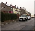
Row of houses above Upland Drive, Trevethin
Houses on this side of Upland Drive are set slightly above road level.
Image: © Jaggery
Taken: 5 Dec 2016
0.10 miles
2
Canford Close, Trevethin
Cul-de-sac on the southeast side of Glen View Road.
Image: © Jaggery
Taken: 5 Dec 2016
0.10 miles
3
Higher level and lower level houses, Upland Drive, Trevethin
Houses on the north side are set several metres higher than the houses on the south side.
Image: © Jaggery
Taken: 5 Dec 2016
0.10 miles
4
Central Drive, Trevethin
From Glen View Road, Central Drive extends for 300 metres to Bythway Road.
Image: © Jaggery
Taken: 5 Dec 2016
0.10 miles
5
Upland Drive bus stop, Trevethin
In December 2016 this stop is on Stagecoach bus route 15.
Image: © Jaggery
Taken: 5 Dec 2016
0.11 miles
6
Houses on top of a grassy bank, Trevethin
Above Upland Drive.
Image: © Jaggery
Taken: 5 Dec 2016
0.11 miles
7
On-street parking, Upland Drive, Trevethin
There are no roadside double yellow lines in this part of Trevethin in December 2016.
Image: © Jaggery
Taken: 5 Dec 2016
0.11 miles
8
Rooftop solar panels, Upland Drive, Trevethin
Viewed in December 2016. There were no panels here in a May 2011 Google Earth Street View.
Image: © Jaggery
Taken: 5 Dec 2016
0.11 miles
9
Newman Road, Trevethin
Viewed from the corner of Beeches Road. Trevethin is on hilly ground in the north of Pontypool.
Here, the houses on the left (east) side of the road are set a couple of metres higher than the houses on the right.
Image: © Jaggery
Taken: 5 Dec 2016
0.11 miles
10
Steps down to Upland Drive houses, Trevethin
Houses on this side of Upland Drive are below road level
whereas those on the opposite side http://www.geograph.org.uk/photo/5296513 are above road level.
Image: © Jaggery
Taken: 5 Dec 2016
0.11 miles


