1
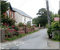
Houses between the two arms of Old Penygarn, Pontypool
The turning on the left leads to a road following an elongated horseshoe course through Old Penygarn. The houses, on Penygarn Road, occupy the 30 metre long space between the two ends of the horseshoe.
Image: © Jaggery
Taken: 1 Jun 2011
0.08 miles
2
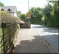
No footway for 30 yards, Penygarn Road, Pontypool
Fortunately there is a footpath http://www.geograph.org.uk/photo/2429907 along the perimeter of Penygarn Infants School which gives a safe alternative route for walkers.
Image: © Jaggery
Taken: 27 May 2011
0.11 miles
3
One way system, Penygarn Road, Pontypool
Viewed from the corner of Channel View. The narrow section of Penygarn Road ahead has one-way traffic.
Image: © Jaggery
Taken: 1 Jun 2011
0.12 miles
4
Tabernacle Baptist Church, Penygarn, Pontypool
Located on the north side of Penygarn Road, the church was built in 1727.
A part of the church hall can be glimpsed behind the church.
Image: © Jaggery
Taken: 1 Jun 2011
0.12 miles
5
The Old Manse, Penygarn, Pontypool
Located next to Tabernacle Baptist Church, http://www.geograph.org.uk/photo/2438410 Penygarn Road.
Image: © Jaggery
Taken: 1 Jun 2011
0.12 miles
6
Warning of pedestrians in Penygarn Road, Pontypool
On the approach to Tabernacle Baptist Church, http://www.geograph.org.uk/photo/2438410 a sign on the right warns
CAUTION. PEDESTRIANS AND VEHICLES ENTERING ROAD BLIND FROM RIGHT 15 METRES AHEAD.
Image: © Jaggery
Taken: 1 Jun 2011
0.12 miles
7
Pontypool and Cwm Afon
With the A472 heading westwards to Abercynon at the left hand side of the picture, and the A4043 heading up the valley right to Abertillery.
Image: © M J Richardson
Taken: 4 Oct 2010
0.12 miles
8
Over Pontypool Park
Over the park to Llanegfedd Reservoir from Pentranch.
Image: © brian walker
Taken: 24 Oct 2008
0.12 miles
9
Path to Old Penygarn
A path heads south away from the Yew Tree Italian Restaurant http://www.geograph.org.uk/photo/2431149 Trevethin.
Image: © Jaggery
Taken: 27 May 2011
0.12 miles
10
Welcome to St Cadocs
The sign is on the side of Penygarn Road, at the St Cadoc's Road turning (on the right). The community of St Cadocs is in NE Pontypool, adjacent to Penygarn and Trevethin.
The ancient church of St Cadoc is nearby.
Image: © Jaggery
Taken: 27 May 2011
0.15 miles


