1
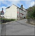
Up Upper Trosnant Street, Pontypool
From Trosnant Street, Upper Trosnant Street ascends towards Clarence Street.
The sign on the left shows that Upper Trosnant Street is one-way for vehicles.
Image: © Jaggery
Taken: 26 Jul 2020
0.00 miles
2
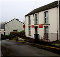
The Hanbury Arms, Pontypool
Image: © John Lord
Taken: 2 Mar 2011
0.01 miles
3
Political office, Pontypool
The office is at 73 Upper Trosnant Street, viewed in early November 2015
when the names on the wall are Nick Thomas-Symonds MP, and Lynne Neagle AM.
Nick Thomas-Symonds is Labour Party MP (Member of Parliament) for Torfaen.
Lynne Neagle is Labour Party AM (National Assembly for Wales member) for Torfaen.
Image: © Jaggery
Taken: 3 Nov 2015
0.01 miles
4
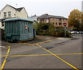
Trosnant electricity substation, Pontypool
The Western Power Distribution electricity substation is located at the northern edge of Clarence Corner car park. Its identifier is TROSNANT S/S No. 53-6744.
Image: © Jaggery
Taken: 3 Nov 2015
0.01 miles
5
Weedy former electricity substation, Trosnant, Pontypool
Located between Upper Trosnant Street on the left and Trosnant Street on the right.
In November 2015, weeds sprout from an enclosure which formerly contained an electricity substation.
Showing TROSNANT P/POOL S/S No. 536744, the Western Power Distribution identifier label remains on the enclosure. The same S/S number is on its modern replacement nearby. http://www.geograph.org.uk/photo/4726461
Image: © Jaggery
Taken: 3 Nov 2015
0.01 miles
6
Entrance to Clarence Place Car Park, Pontypool
From the south side of Trosnant Street. The sign on the right shows that this car park is free (am ddim in Welsh). MEWN painted on the road surface is Welsh for IN.
Image: © Jaggery
Taken: 26 Jul 2020
0.01 miles
7
White marked area in Clarence Place Car Park, Pontypool
Recharging area for two electric vehicles.
Image: © Jaggery
Taken: 26 Jul 2020
0.01 miles
8
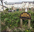
Valley Initiative Scheme sign at the edge of Clarence Place Car Park, Pontypool
The years on the sign are 1987 and 1990.
Image: © Jaggery
Taken: 26 Jul 2020
0.01 miles
9
No Entry signs, Trosnant Street, Pontypool
The message for drivers conveyed by the wordless signs is emphasised
by NO ENTRY and the Welsh DIM MYNEDIAD painted on the road surface.
Image: © Jaggery
Taken: 26 Jul 2020
0.01 miles
10
Green cabinet, Trosnant, Pontypool
The Western Power Distribution electricity substation is at the northern edge of Clarence Place car park. Its identifier is TROSNANT S/S 53-6744. The white markings on the left are part of an electric vehicle recharging area. https://www.geograph.org.uk/photo/6552783
Image: © Jaggery
Taken: 26 Jul 2020
0.01 miles


