IMAGES TAKEN NEAR TO
Beech Tree Terrace, PONTYPOOL, NP4 6PS

Introduction

This page details the photographs taken nearby to Beech Tree Terrace, NP4 6PS by members of the Geograph project.

The Geograph project started in 2005 with the aim of publishing, organising and preserving representative images for every square kilometre of Great Britain, Ireland and the Isle of Man.

There are currently over 7.5m images from over14,400 individuals and you can help contribute to the project by visiting https://www.geograph.org.uk

Image Map


Images are licensed for reuse under creativecommons.org/licenses/by-sa/2.0
Notes
  • Clicking on the map will re-center to the selected point.
  • The higher the marker number, the further away the image location is from the centre of the postcode.

Image Listing (193 Images Found)

Images are licensed for reuse under creativecommons.org/licenses/by-sa/2.0
  • ...
Image
Details
Distance
1
SE edge of Charlesville, Pontypool
Viewed across Pentre-piod Road. Next to a wall-mounted postbox and the Charlesville sign, a large sign states that the turning leads to Grove Terrace, Park Terrace, Rochdale Terrace and Grove Estate.
Image: © Jaggery Taken: 26 May 2011
0.04 miles
2
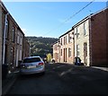
West along Mount Pleasant Road, Pontnewynydd
In the distance the road ends at the edge of allotments.
Image: © Jaggery Taken: 2 Nov 2018
0.06 miles
3
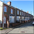
Row of houses, Mount Pleasant Road, Pontnewynydd
On the south side of the road, on the left here. https://www.geograph.org.uk/photo/5961991
Image: © Jaggery Taken: 2 Nov 2018
0.06 miles
4
Mountain View Road, Pontypool
Mountain View Road climbs steeply away from Hanbury Road.
Image: © Jaggery Taken: 26 May 2011
0.06 miles
5
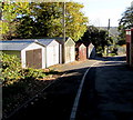
Lockup garages in Pontnewynydd
Alongside a side road east of Church Road.
Image: © Jaggery Taken: 2 Nov 2018
0.07 miles
6
Coronation Terrace, Cwm Ffrwd-oer
Image: © Roger Cornfoot Taken: 11 Apr 2007
0.08 miles
7
The Woods electricity substation and local transformer, Pentrepiod, Torfaen
The Western Power Distribution site is set back from the north side of Pentrepiod Road. The electricity substation identifier is The Woods Pentrepiod S/S 532632. The local transformer identifier is 53-2632A.
Image: © Jaggery Taken: 6 Nov 2018
0.09 miles
8
South along Chapel Road, Pontnewynydd
The Waunddu junction is on the right.
Image: © Jaggery Taken: 2 Nov 2018
0.09 miles
9
Sawtells Terrace, Pontnewynydd
Row of houses alongside Church Road.
Image: © Jaggery Taken: 2 Nov 2018
0.09 miles
10
Row of four houses, Pentrepiod Road, Pentrepiod, Torfaen
The Lewis Wood junction is on the left.
Image: © Jaggery Taken: 6 Nov 2018
0.09 miles
  • ...