1
Twissell's Road, Tranch, Pontypool
Houses on the west side of the road viewed from Tranch Road.
Image: © Jaggery
Taken: 16 May 2011
0.01 miles
2
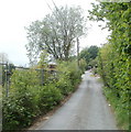
Narrow Tranch Road, Pontypool
The view west along narrow, pavementless Tranch Road, west of the Twissell's Road turning. http://www.geograph.org.uk/photo/2415117
Image: © Jaggery
Taken: 16 May 2011
0.01 miles
3
Modern houses, Tranch Road, Pontypool
Recently-built houses on the north side of Tranch Road, Tranch, opposite Hill Close.
Image: © Jaggery
Taken: 16 May 2011
0.07 miles
4
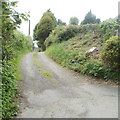
Tranch Road, Tranch, Pontypool
Tranch Road climbs away westwards from the Parke's Lane junction.
Image: © Jaggery
Taken: 16 May 2011
0.12 miles
5
Regency House residential home, Tranch, Pontypool
The NE side of a privately-owned care home, on the corner of Parke's Lane and Wentsland Road.
Image: © Jaggery
Taken: 16 May 2011
0.13 miles
6
House at the top end of Tranch Road, Pontypool
Viewed from the junction of Tranch Road and Coch-y-north Road, near the track http://www.geograph.org.uk/photo/2415165 to Grade II listed Gellipistyll farmhouse. http://www.geograph.org.uk/photo/2415159
Image: © Jaggery
Taken: 16 May 2011
0.13 miles
7
Coch-y-north Road, Tranch, Pontypool
The view from sunshine at the top (western) end of Tranch Road into the wooded gloom of Coch-y-north Road.
Image: © Jaggery
Taken: 16 May 2011
0.13 miles
8
Track to Gellipistyll farm, Tranch
The track heads away from the junction of Tranch Road and Coch-y-north Road towards the Grade II listed Gellipistyll farmhouse. http://www.geograph.org.uk/photo/2415159
Image: © Jaggery
Taken: 16 May 2011
0.13 miles
9
Western section of Parke's Lane, Tranch, Pontypool
The course of Parke's Lane bends through 90 degrees at Regency House. http://www.geograph.org.uk/photo/2417135
This view is to the WSW, along the perimeter wall of Regency House, looking in the direction of Crumlin Road.
Image: © Jaggery
Taken: 16 May 2011
0.13 miles
10
Field, woods and a distant hillside, Tranch, Pontypool
A view to the SW from near Regency House. http://www.geograph.org.uk/photo/2417135
Image: © Jaggery
Taken: 16 May 2011
0.17 miles


