1
Narberth Crescent, Llanyravon, Cwmbran
Cul-de-sac on the west side of Liswerry Drive.
The sign shows that Narberth Crescent leads to Cilgerran Court and Rumney Walk.
Image: © Jaggery
Taken: 12 Apr 2017
0.02 miles
2
Liswerry Drive, Llanyrafon, Cwmbran
This is the north end of Liswerry Drive, close to the Methodist church. http://www.geograph.org.uk/photo/1704014 These houses are on the east side of the road.
Image: © Jaggery
Taken: 11 Feb 2010
0.02 miles
3
Liswerry Drive bus stop, Llanyravon, Cwmbran
This stop near the Narberth Crescent junction is on bus route 3 to Cwmbran bus station.
In April 2017 the route is operated by Anslow Bus & Coach Travel. http://www.geograph.org.uk/photo/5340188
Image: © Jaggery
Taken: 12 Apr 2017
0.03 miles
4
Dynevor Close, Llanyravon, Cwmbran
Houses alongside a path on the east side of Liswerry Drive.
Image: © Jaggery
Taken: 12 Apr 2017
0.03 miles
5
Cwmbran Pine Centre
On Turnpike Road, close to the junction with the A4042.
Image: © Jaggery
Taken: 8 Oct 2009
0.04 miles
6
Welsh Water Valve House number 5, Cwmbran
This stone structure in Llanyravon, Cwmbran is similar to a larger version in Malpas, Newport.
See http://www.geograph.org.uk/photo/1440132 for a description of the part the structures play in the supply of drinking water.
Image: © Jaggery
Taken: 13 Sep 2011
0.04 miles
7
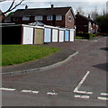
Pembroke Place lockup garages, Llanyravon, Cwmbran
Viewed from Liswerry Drive.
Image: © Jaggery
Taken: 12 Apr 2017
0.04 miles
8
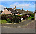
Tretower Court, Llanyravon, Cwmbran
Bungalows between Dunraven Road and Narberth Crescent.
Image: © Jaggery
Taken: 12 Apr 2017
0.04 miles
9
Liswerry Drive houses on the corner of Dunraven Road, Cwmbran
Viewed across Liswerry Drive past the left turn into Dunraven Road.
Image: © Jaggery
Taken: 22 Aug 2012
0.05 miles
10
Pembroke Place, Cwmbran
A cul-de-sac on the east side of Liswerry Drive.
Image: © Jaggery
Taken: 22 Aug 2012
0.05 miles


