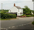
IMAGES TAKEN NEAR TO
Pentre Lane, CWMBRAN, NP44 7AR

Introduction

This page details the photographs taken nearby to Pentre Lane, NP44 7AR by members of the Geograph project.

The Geograph project started in 2005 with the aim of publishing, organising and preserving representative images for every square kilometre of Great Britain, Ireland and the Isle of Man.

There are currently over 7.5m images from over14,400 individuals and you can help contribute to the project by visiting https://www.geograph.org.uk

Image Map


Images are licensed for reuse under creativecommons.org/licenses/by-sa/2.0
Notes
  • Clicking on the map will re-center to the selected point.
  • The higher the marker number, the further away the image location is from the centre of the postcode.

Image Listing (12 Images Found)

Images are licensed for reuse under creativecommons.org/licenses/by-sa/2.0
Image
Details
Distance
1
Farmland near Pentre Cottage
Image: © Alan Hughes Taken: 5 Sep 2022
0.04 miles
2
Pentre Cottage, Pentre Lane
Image: © Jaggery Taken: 11 Jun 2010
0.06 miles
3
Greenfield, Pentre Lane
House on the north side of Pentre Lane.
Image: © Jaggery Taken: 11 Jun 2010
0.11 miles
4
Private road heads away from Pentre Lane
Faded white letters on the road surface declare that this is a private road. It leads from the north side on Pentre Lane to Pentre-bach farm.
Image: © Jaggery Taken: 11 Jun 2010
0.11 miles
5
Broadoaks, Pentre Lane
Image: © Roger Cornfoot Taken: 1 Mar 2007
0.11 miles
6
Pentre Lane narrows to a single track
Just beyond Eureka House,http://www.geograph.org.uk/photo/1909379 Pentre Lane, heading west, narrows to a single-track lane. On the left is the turning for Trawsmawr Lane.http://www.geograph.org.uk/photo/1909366
Image: © Jaggery Taken: 11 Jun 2010
0.15 miles
7
Trawsmawr Lane heads away from Pentre Lane
Trawsmawr Lane heads towards the northwest edge of Bettws, Newport.
Image: © Jaggery Taken: 11 Jun 2010
0.15 miles
8
Eureka House, Pentre Lane
Located adjacent to the turning for Trawsmawr Lane.http://www.geograph.org.uk/photo/1909366 A small sign on the building reads EUREKA WELSH COBS. Cob has numerous meanings, including a male swan and a kind of loaf, but I'd guess that the cob meant here is a sturdy short-legged riding-horse.
Image: © Jaggery Taken: 11 Jun 2010
0.15 miles
9
Large puddle in Pentre Lane
Puddle is perhaps an understatement. The body of water extended for several tens of metres, covered the entire width of the roadway and was several inches deep. There was no way round it. My walking shoes are waterproof in most situations, but here the water entered over the tops of my shoes, leading to a squelchy final part of my walk. Viewed from the edge of Ty-gwyn.
Image: © Jaggery Taken: 15 Dec 2011
0.20 miles
10
Eureka farm, Pentre Lane
Rearing Welsh Cobbs.
Image: © Roger Cornfoot Taken: 1 Mar 2007
0.21 miles