1
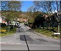
Tram Road service reservoir, Upper Cwmbran
Image: © Jaggery
Taken: 17 Oct 2009
0.10 miles
2
Bagley Court, Thornhill, Cwmbran
Cul-de-sac above Hafren Road.
Image: © Jaggery
Taken: 6 Apr 2017
0.12 miles
3
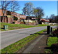
Junction of Marl Court and Hafren Road, Thornhill, Cwmbran
Marl Court from the right joins Hafren Road.
Image: © Jaggery
Taken: 6 Apr 2017
0.13 miles
4
School entrance path, Upper Cwmbran
From Thornhill Road towards Woodlands Community Primary School and Integrated Children's Centre.
Image: © Jaggery
Taken: 29 Mar 2017
0.14 miles
5
Ordnance Survey Cut Mark
This OS cut mark can be found on No31 Bagley Court. It marks a point 163.170m above mean sea level.
Image: © Adrian Dust
Taken: 17 Aug 2020
0.14 miles
6
Steps up to Bagley Court, Thornhill, Cwmbran
Ascending from Hafren Road.
Image: © Jaggery
Taken: 6 Apr 2017
0.15 miles
7
Hafod Court Road, Thornhill, Cwmbran
Hafod Court Road ascends from Hafren Road. The lorry is on the corner of Berkeley Court.
Image: © Jaggery
Taken: 6 Apr 2017
0.15 miles
8
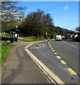
Thornhill Road bus stop and shelter, Upper Cwmbran
The stop is on Stagecoach bus route 1 from Thornhill to Cwmbran bus station.
Image: © Jaggery
Taken: 6 Apr 2017
0.15 miles
9
Woodlands School Excellent banner facing Thornhill Road, Upper Cwmbran
After the Estyn inspection in early 2014, Woodlands Community Primary School's performance and future prospects were both classed as excellent.
The name sign on the right shows Woodlands Community Primary School and Integrated Children's Centre.
Image: © Jaggery
Taken: 29 Mar 2017
0.16 miles
10
Hafren Road telecoms cabinets, Thornhill, Cwmbran
Alongside Hafren Road between the Marl Court junction and the Bagley Court junction.
Image: © Jaggery
Taken: 6 Apr 2017
0.16 miles


