1
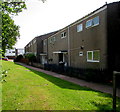
Multi-use sports court, Greenmeadow, Cwmbran
Set back 80 metres from Ty Gwyn Way.
Image: © Jaggery
Taken: 30 May 2016
0.10 miles
2
Up Byways, Greenmeadow, Cwmbran
The road named Byways ascends from Fairhill towards the Threepenny Bit Community Centre. http://www.geograph.org.uk/photo/5151535
A warning sign shows Humps for 600 yards. The trees are alongside Dowlais Brook.
Image: © Jaggery
Taken: 10 Oct 2016
0.11 miles
3
Junction of Ty Gwyn Way and Barnets, Greenmeadow, Cwmbran
Viewed across Ty Gwyn Way. The cul-de-sac named Barnets extends ahead for 170 metres.
Image: © Jaggery
Taken: 30 May 2016
0.11 miles
4
Beddick, Greenmeadow, Cwmbran
Beddick is a cul-de-sac extending for 60 metres from Ty Gwyn Way.
Image: © Jaggery
Taken: 30 May 2016
0.11 miles
5
Fairhill Methodist Church, Cwmbran
Located on the east side of a road named Fairhill, facing houses on Byways. The church was built in the mid 1960s.
It may look like the bus stops are ideally placed for those attending Sunday services here, but the reality is that Stagecoach, the major provider of bus services in Cwmbran, do not run any local buses in the town on Sundays. The only buses currently seen in Cwmbran on Sundays are those on long-distance routes passing through the town, such as Newport to Pontypool and Blaenavon.
Image: © Jaggery
Taken: 30 Jan 2011
0.12 miles
6
Fairhill, Cwmbran
The view north up Fairhill. On the left is the edge of St Peter's Close. The houses in the distance are part of Byways, which follows a pattern in this area of streets with one-word names. See http://www.geograph.org.uk/photo/2287265 for other examples.
Image: © Jaggery
Taken: 30 Jan 2011
0.12 miles
7
Illegal to ride motor vehicles on this path near Beddick, Cwmbran
The red and white notice states that it is illegal to ride motor vehicles in this area.
Offenders are liable to prosecution. The text is also in Welsh.
Image: © Jaggery
Taken: 30 May 2016
0.12 miles
8
Threepenny Bit Community Centre, Greenmeadow, Cwmbran
Located above Dowlais Brook, alongside the road named Byways, this building is the home of CoStar, an independent local charity. Formed in 2000 by a small group of residents with a passion to help and develop their community, CoStar was originally located at Blenheim shops. It moved to the Threepenny Bit Community Centre in 2012. CoStar is involved in a wide range of projects, events and activities aimed at developing and supporting the Cwmbran communities of Greenmeadow, Fairwater, St Dials, Coed Eva and Upper Cwmbran.
Image: © Jaggery
Taken: 10 Oct 2016
0.13 miles
9
Warning sign - Patrol/Hebryngwr, Fairhill, Greenmeadow, Cwmbran
The bilingual (English/Welsh) sign faces Fairhill in the Greenmeadow area of Cwmbran.
The Stagecoach bus is on Route 5 to Cwmbran bus station.
Image: © Jaggery
Taken: 10 Oct 2016
0.13 miles
10
Beddick houses, Greenmeadow, Cwmbran
Beddick is a cul-de-sac on the south side of Ty Gwyn Way.
Image: © Jaggery
Taken: 30 May 2016
0.13 miles


