1
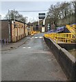
Brunel Road, Fairwater, Cwmbran
Houses built c1970, viewed from the corner of Ty Gwyn Way.
Image: © Jaggery
Taken: 30 Jan 2011
0.04 miles
2
Ordnance Survey Cut Mark
This OS cut mark can be found on No 24 Oaksford. It marks a point 131.050m above mean sea level.
Image: © Adrian Dust
Taken: 17 Aug 2020
0.06 miles
3
Exit road, Fairwater, Cwmbran
This is the exit road from the Cwmbran High School and Fairwater Leisure Centre site.
Turn right ahead for the gentle ascent https://www.geograph.org.uk/photo/7118009 to Ty Gwyn Way.
Image: © Jaggery
Taken: 13 Mar 2022
0.08 miles
4
Yellow-marked parking area, Fairwater, Cwmbran
These parking spaces are reserved for the vehicles of Blue Badge holders. A dark green Western Power Distribution electricity substation https://www.geograph.org.uk/photo/7118020 is on the right. Cwmbran High School and Fairwater Community Centre are behind the camera.
Image: © Jaggery
Taken: 13 Mar 2022
0.08 miles
5
Dark green cabinet, Fairwater, Cwmbran
The cabinet is a Western Power Distribution electricity substation located near Cwmbran High School. The substation identifier is 53-1959.
Image: © Jaggery
Taken: 13 Mar 2022
0.08 miles
6
Bilingual name on a Cwmbran High School building
LOWER BLOCK is BLOC ISAF in Welsh.
Image: © Jaggery
Taken: 13 Mar 2022
0.08 miles
7
Oaksford, Cwmbran
Houses on the corner of Oaksford, viewed across Ty Gwyn Way.
Image: © Jaggery
Taken: 30 Jan 2011
0.09 miles
8
Fairwater Leisure Centre, Cwmbran
Accessed from Ty Gwyn Way, Fairwater Leisure Centre is adjacent to Cwmbran High School.
Image: © Jaggery
Taken: 13 Mar 2022
0.09 miles
9
Two large red Biffa bins, Fairwater, Cwmbran
A Cwmbran High School building is in the background.
Image: © Jaggery
Taken: 13 Mar 2022
0.10 miles
10
Priority traffic sign, Fairwater, Cwmbran
Vehicles leaving Cwmbran High School and Fairwater Leisure Centre have priority over oncoming traffic.
Image: © Jaggery
Taken: 13 Mar 2022
0.10 miles


