1
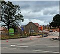
Abbey Woods, Llantarnam, Cwmbran
New housing viewed across Newport Road in July 2023.
The white-on-green sign on the left shows Enzo's homes Abbey Woods.
Image: © Jaggery
Taken: 1 Jul 2023
0.03 miles
2
STS lorry, Newport Road, Llantarnam, Cwmbran
Text on the side of the lorry in February 2021 shows that STS = Systems Transport Services.
Image: © Jaggery
Taken: 27 Feb 2021
0.03 miles
3
Keep Right signs, Newport Road, Llantarnam, Cwmbran
Temporary traffic lights are between temporary Keep Right signs
near cones blocking the left side of the road.
The temporary white-on-red sign on the left shows
"4-WAY CONTROL
WAIT HERE UNTIL GREEN LIGHT SHOWS"
and the Welsh equivalent.
Image: © Jaggery
Taken: 1 Jul 2023
0.03 miles
4
SAFLE BWS AR GAU / BUS STOP CLOSED, Llantarnam, Cwmbran
Welsh / English temporary sign alongside Newport Road in July 2023.
Image: © Jaggery
Taken: 1 Jul 2023
0.03 miles
5
Pedestrian refuge, Newport Road, Llantarnam, Cwmbran
The white arrow nearer the refuge points towards the Maltings junction. https://www.geograph.org.uk/photo/5879611
Image: © Jaggery
Taken: 21 Aug 2018
0.04 miles
6
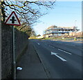
Warning sign - minor crossroads, Newport Road, Llantarnam, Cwmbran
On the approach to the Malthouse Lane junction and the Pentre Lane junction.
Image: © Jaggery
Taken: 27 Feb 2021
0.04 miles
7
Stagecoach bus 47637, Newport Road, Llantarnam, Cwmbran
On Stagecoach Route 23 to Market Square bus station in Newport in July 2023.
Image: © Jaggery
Taken: 1 Jul 2023
0.04 miles
8
LJB van, Llantarnam, Cwmbran
LJB Plastering Contractors' van travelling south on Newport Road in July 2023.
Image: © Jaggery
Taken: 1 Jul 2023
0.04 miles
9
Newport Road, Llantarnam, Cwmbran
Newport Road climbs away from the roundabout at the Llantarnam Park Way junction towards Newport. On the left is an entrance to Llantarnam Abbey. http://www.geograph.org.uk/photo/1595825
Image: © Jaggery
Taken: 25 Aug 2009
0.04 miles
10
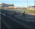
Newport Road pedestrian refuge, Llantarnam, Cwmbran
Between Keep Left signs, this is one of several similar pedestrian refuges in this part of Newport Road. The Maltings junction is in the background.
Image: © Jaggery
Taken: 27 Feb 2021
0.04 miles


