1
Playground in common land
Just south of the School House on Lower Common.
Image: © Jonathan Billinger
Taken: 3 Dec 2014
0.12 miles
2
Lower Common Road
The public road ends disappointingly at a locked gate with no access to the reservoir.
Image: © Jonathan Billinger
Taken: 3 Dec 2014
0.13 miles
3
Track in Lower Common
Access to a smallholding through wooded common land.
Image: © Jonathan Billinger
Taken: 3 Dec 2014
0.14 miles
4
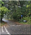
Dead-end School Road, Glascoed, Monmouthshire
School Road is on the south side of crossroads.
Image: © Jaggery
Taken: 17 Oct 2021
0.18 miles
5
River outfall, Llandegfedd Reservoir
Raw water, pumped from the River Usk by the Prioress Mill Pumping Station north west of Usk, enters the enclosed concrete pound, spills over into a channel and flows into the reservoir. The Trail passes by the near railings on a permissive path.
Image: © M J Roscoe
Taken: 26 May 2018
0.19 miles
6
Coed-Chambers Road, Glascoed, Monmouthshire
Looking to the ESE along Coed-Chambers Road from the edge of crossroads.
Image: © Jaggery
Taken: 17 Oct 2021
0.19 miles
7
Entrance to car park, reservoir inlet
The Trail from Yew Tree Farm
Image turns right at the trail's signpost on the highway and heads through the reservoir gates. Access to this area is restricted in the winter.
Image: © M J Roscoe
Taken: 26 May 2018
0.21 miles
8
Signpost at crossroads in Glascoed, Monmouthshire
Right for New Inn and Pontypool, left for Coed-y-Paen, behind the camera for Llanbadoc and Usk.
Image: © Jaggery
Taken: 17 Oct 2021
0.21 miles
9
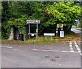
Golf course and chapel direction signs, Glascoed, Monmouthshire
The signs for a golf course (Cwrs Golff in Welsh) and Mount Zion Baptist Chapel are alongside Coed-Chambers Road near crossroads. A bus shelter and a litter bin are on the left.
Image: © Jaggery
Taken: 17 Oct 2021
0.22 miles
10
Way to bird hide, inlet car park
From the picnic site (foreground) the path goes through the gate to the hide a few yards further on to the left. A notice nearby states that access is restricted to permit holders.
Image: © M J Roscoe
Taken: 26 May 2018
0.22 miles


