1
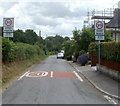
20mph zone, Newton Road, Penperlleni
The 30mph speed limit on Newton Road reduces to 20mph at the Parklands junction. http://www.geograph.org.uk/photo/3169206
Image: © Jaggery
Taken: 30 Jun 2011
0.01 miles
2
Newtown Road houses viewed across the railway, Penperlleni
Viewed from the field side of a level crossing http://www.geograph.org.uk/photo/3169115 across the Welsh Marches railway.
Image: © Jaggery
Taken: 30 Jun 2011
0.02 miles
3
The Marches Line
Freightliner's 66515 with the 08:25 Portbury Coal Terminal to Fiddlers Ferry Power Station working, seen here passing Penperlleni.
Image: © Stuart Wilding
Taken: 11 Sep 2014
0.05 miles
4
Parklands corner, Penperllemi
Houses on the corner of Newtown Road and Parklands.
Image: © Jaggery
Taken: 30 Jun 2011
0.05 miles
5
Houses at the northern end of Newton Road, Penperlleni
Viewed from this bridge. http://www.geograph.org.uk/photo/3186394
Image: © Jaggery
Taken: 30 Jun 2011
0.05 miles
6
Grazing beside Pen-y-wern Wood
Image: © JThomas
Taken: 11 Aug 2021
0.07 miles
7
Stop look listen, Penperlleni
The sign is on the field side http://www.geograph.org.uk/photo/3169095 of a level crossing leading to Newtown Road across the Welsh Marches railway.
Image: © Jaggery
Taken: 30 Jun 2011
0.08 miles
8
Stile into a field alongside Pen-y-wern Wood, Penperlleni
The stile is at the edge of this http://www.geograph.org.uk/photo/3169040 level crossing.
Image: © Jaggery
Taken: 30 Jun 2011
0.08 miles
9
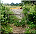
Stile to a level crossing, Penperlleni
Viewed from Newtown Road. If using the stile looks to be too energetic for you, you could try squeezing through the gap on the right. The level crossing http://www.geograph.org.uk/photo/3169040 leads to a track through a field along the edge of Pen-y-wern Wood.
Image: © Jaggery
Taken: 30 Jun 2011
0.08 miles
10
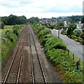
Railway SW of Penwern Lane bridge near Penperlleni
Viewed from this http://www.geograph.org.uk/photo/3186394 bridge.
The next station ahead is Pontypool & New Inn, about 6km away.
Newtown Road is on the right. http://www.geograph.org.uk/photo/3186531
Image: © Jaggery
Taken: 30 Jun 2011
0.08 miles


