1
Lane to Carrow Hill, Monmouthshire
A lane heads away from the A48 towards the hamlet of Carrow Hill, near St Brides Netherwent.
Image: © Jaggery
Taken: 31 Mar 2011
0.11 miles
2
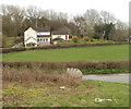
Five Lanes House, west of Caerwent
Viewed from the A48 at Five Lanes junction. http://www.geograph.org.uk/photo/2337074
Located roughly midway between Penhow and Caerwent.
Image: © Jaggery
Taken: 31 Mar 2011
0.12 miles
3
Yellow grit bin at a junction, Five Lanes, Monmouthshire
The road on the left is to Shirefield in rural Monmouthshire .
Image: © Jaggery
Taken: 15 Feb 2012
0.15 miles
4
Eastern Eye near Five Lanes, Monmouthshire
Viewed across the A48. Eastern Eye is an Indian restaurant and takeaway. The building has had several previous names and occupiers. http://www.geograph.org.uk/photo/205609
The metal roller appears to have been on this corner for several years, at least. Its significance is unknown to this contributor.
Image: © Jaggery
Taken: 31 Mar 2011
0.16 miles
5
Restaurant on the A48 near Five Lanes
Years ago this place was known as "The Austral Cafe", later it became "The Wentwood Inn". It no longer has an obvious sign.
Update 2016: demolished.
Image: © Roy Parkhouse
Taken: 20 Jul 2006
0.16 miles
6
Footpath alongside A48 near Five Lanes junction, Monmouthshire
Looking in the direction of Penhow.
Image: © Jaggery
Taken: 31 Mar 2011
0.18 miles
7
A48 heads west past Five Lanes junction
The hoardings on the left are advertising the Eastern Eye, http://www.geograph.org.uk/photo/2491074 out of shot on the left. On the right are Five Lanes Cottages. http://www.geograph.org.uk/photo/2337123
Image: © Jaggery
Taken: 31 Mar 2011
0.18 miles
8
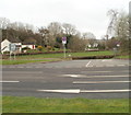
A48 junction for Five Lanes and Carrow Hill, Monmouthshire
Viewed across the A48. The sign on the left shows Five Lanes and Carrow Hill.
Image: © Jaggery
Taken: 31 Mar 2011
0.18 miles
9
Sign advertising agricultural sale near Five Lanes, Monmouthshire
The sign is on the north side of the A48, a few metres west of the Five Lanes junction. It announces a collective sale of tractors, agricultural machinery, implements & equipment here on Saturday April 16th 2011.
Image: © Jaggery
Taken: 31 Mar 2011
0.18 miles
10
Bridleway near Orchard Cottage, Five Lanes
The bridleway heads west away from Orchard Cottage. http://www.geograph.org.uk/photo/3920000
A bridleway is a footpath that can also be used by a person riding or leading a horse.
Image: © Jaggery
Taken: 15 Feb 2012
0.18 miles


