1
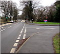
A48 pelican crossing near Dinham Road, Caerwent
Viewed along the A48 from opposite the Dinham Road junction. http://www.geograph.org.uk/photo/4806210
Chambers Dictionary states that "pelican" is adapted from "pedestrian light controlled crossing".
Image: © Jaggery
Taken: 24 Jan 2016
0.05 miles
2
Caerwent - Houses Under Construction
Image: © Roy Parkhouse
Taken: 18 Feb 2005
0.06 miles
3
Dinham Road, Caerwent
On the north side of the A48.
Image: © Jaggery
Taken: 24 Jan 2016
0.06 miles
4
Junction of the A48 and Dinham Road, Caerwent
The A48 towards Newport passes the right turn into Dinham Road. http://www.geograph.org.uk/photo/4806210
Image: © Jaggery
Taken: 24 Jan 2016
0.06 miles
5
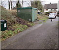
Gas installation below the A48 in Caerwent
The large green box is a Wales & West Utilities gas installation.
The small green bin is for dog waste only - no litter.
The A48 is above the grassy bank.
Image: © Jaggery
Taken: 24 Jan 2016
0.07 miles
6
Wales & West Utilities gas installation, Caerwent
Alongside a footpath at the bottom of a bank below the A48. On a door, an EX
in a black-lined yellow triangle indicates a potentially explosive atmosphere - smoking prohibited.
Image: © Jaggery
Taken: 24 Jan 2016
0.07 miles
7
Track past an Ancient Roman wall, Caerwent
Viewed from a gate on the south side of the A48. The wall is one of many remnants of the Ancient Roman town of Venta Silurum to be seen in Caerwent. Venta was set up by the Romans in 75 AD as an administrative centre for the defeated Silures tribe.
Image: © Jaggery
Taken: 24 Jan 2016
0.08 miles
8
Two businesses alongside the A48, Caerwent
That Media Group head office http://www.geograph.org.uk/photo/4806187 is on the left.
Spot Music (guitar and drums lessons) on the right. http://www.geograph.org.uk/photo/4806179
Image: © Jaggery
Taken: 24 Jan 2016
0.08 miles
9
That Media Group head office, Caerwent
Located in Green Lane Studio on the south side of the A48. The company website states
"That Media Group provides consultancy in design, marketing, print and web. We’ll see the whole picture
and take you through from design concepts to marketing strategy to printed materials to web presence".
Image: © Jaggery
Taken: 24 Jan 2016
0.08 miles
10
Green Lane Studio, Caerwent
Premises of Spot Music, on the south side of the A48.
Spot Music provides professional guitar, drum, bass and music theory tuition.
Image: © Jaggery
Taken: 24 Jan 2016
0.10 miles


