1
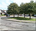
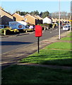
Junction of Cas Troggy with Sandy Lane, Caldicot
Image: © Ruth Sharville
Taken: 8 Dec 2020
0.06 miles
2
Bethany Baptist Fellowship, Caldicot
Located in the north of Caldicot, between Cas Troggy, Neddern Way and Brookside.
Image: © Jaggery
Taken: 14 Aug 2010
0.07 miles
3
Cas Troggy, Caldicot
Cas Troggy has an L-shaped arrangement of houses on the eastern side of Sandy Lane. These are located near the angle of the L. The unusual name is probably a reference to a ruined Welsh castle. http://www.geograph.org.uk/photo/570336
Image: © Jaggery
Taken: 14 Aug 2010
0.07 miles
4
National Cycle Route 4 heading south, Caldicot
The route heads towards the centre of Caldicot. A few metres behind the camera is Bethany Baptist Fellowship Church. http://www.geograph.org.uk/photo/2011819
Image: © Jaggery
Taken: 14 Aug 2010
0.13 miles
5
Caldicot : cycle track adjacent to Baptist church
A cycle track, part of National Cycle Route 4, heads north past Bethany Baptist Fellowship church. http://www.geograph.org.uk/photo/2011819
Image: © Jaggery
Taken: 14 Aug 2010
0.13 miles
6
Wentwood View, Caldicot
Houses at the SE end of Wentwood View.
Image: © Jaggery
Taken: 14 Aug 2010
0.15 miles
7
Caldicot : Tree-lined island at the SW edge of Wentwood View
The course of Wentwood View makes an irregular shape near the NE edge of Caldicot.
This tree-lined island is at the SW edge of Wentwood View, a few metres east of National Cycle Route 4. http://www.geograph.org.uk/photo/2011822
Image: © Jaggery
Taken: 14 Aug 2010
0.15 miles
8
Margretts Way rooftop solar panels, Caldicot
This part of Margretts Way is opposite Priory Close.
Image: © Jaggery
Taken: 19 Jan 2020
0.17 miles
9
Rooftop solar panels, Sandy Lane, Caldicot
Near the corner of Margretts Way (Ffordd Margrett in Welsh).
Image: © Jaggery
Taken: 19 Jan 2020
0.17 miles
10
Queen Elizabeth II postbox, Sandy Lane, Caldicot
A Woodland Vanhire & Removals vehicle is in the background.
Image: © Jaggery
Taken: 19 Jan 2020
0.17 miles


