1
Choir Hall, Caldicot
Caldicot Male Voice Choir's purpose designed and built hall, the result of much fund raising and local support, was opened on September 21st 1996. Located near Caldicot Leisure Centre, the Mill Lane hall is maintained solely by choir members. The hall is used extensively for social functions, meetings, concerts, blood donor sessions etc.
Image: © Jaggery
Taken: 11 May 2014
0.02 miles
2
Army Cadet Force hut in Caldicot
In a fenced enclosure (topped with barbed wire) on the north side of Mill Lane.
Image: © Jaggery
Taken: 11 May 2014
0.03 miles
3
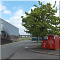
Donation bins outside Caldicot Leisure Centre
The red bins are for donations to the British Heart Foundation.
The bigger bin is a Clothing Bank. The smaller bin is a Books & Music Bank.
Image: © Jaggery
Taken: 11 May 2014
0.03 miles
4
Mill Lane gas installation in Caldicot
The Wales & West Utilities (WWU) gas installation is in a fenced compound on the north side of Mill Lane, between Curlew Avenue and Kingfisher Close. On the box, an EX in a black-lined yellow triangle indicates a potentially explosive atmosphere - smoking prohibited. A notice shows a WWU phone number to ring before beginning any works on, or within 10 metres of, this site.
Image: © Jaggery
Taken: 11 May 2014
0.03 miles
5
Entrance to the main building at Caldicot Leisure Centre
The Monmouthshire County Council leisure centre is on the north side of Mill Lane.
Image: © Jaggery
Taken: 11 May 2014
0.04 miles
6
Caldicot Skatepark
Near the main building in Caldicot Leisure Centre, Mill Lane.
Image: © Jaggery
Taken: 11 May 2014
0.05 miles
7
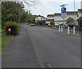
Traffic calming on Mill Lane, Caldicot
For a couple of metres, the roadway has been narrowed to less than the width of two cars.
Vehicles travelling away from the camera have priority. The dark red box is for dog waste.
Image: © Jaggery
Taken: 11 May 2014
0.06 miles
8
Kingfisher Close bungalows, Caldicot
On the south side of Mill Lane.
Image: © Jaggery
Taken: 11 May 2014
0.06 miles
9
Nightingale Close, Caldicot
Viewed across Mill Lane. The bilingual name sign shows that eos is Welsh for nightingale.
Image: © Jaggery
Taken: 11 May 2014
0.06 miles
10
Speed limit 5mph on school roads, Caldicot
Inside the Caldicot Comprehensive School site, viewed over this http://www.geograph.org.uk/photo/4045385 gate.
Image: © Jaggery
Taken: 11 May 2014
0.07 miles


