1
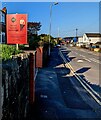
Clarke board, Pillmawr Road, Malpas, Newport
In May 2023 the Clarke estate agency board shows "We sell homes, not houses"
Image: © Jaggery
Taken: 20 May 2023
0.01 miles
2
IT'S SOLD, Pillmawr Road, Malpas, Newport
Clarke estate agency board on June 28th 2023.
Image: © Jaggery
Taken: 28 Jun 2023
0.01 miles
3
Vote Labour placard, Pillmawr Road, Malpas, Newport
A Vote Labour placard is on display on May 13th 2017, less than a month before the UK General Election on Thursday June 8th 2017. This area is part of the Newport West Parliamentary Constituency. At the 2015 General Election, the Newport West seat was won by the Labour Party with 16,633 votes. The Conservative Party was in second place with 13,123 votes. If the predicted swing to the Conservatives occurs, the 2017 winning majority in Newport West could be very small...
Image: © Jaggery
Taken: 13 May 2017
0.01 miles
4
Speed bumps near Malpas Community Centre and Library, Newport
One of several pairs of bumps/humps across Pillmawr Road on the approach to a primary school.
The Malpas Community Centre and Library nameboard is on the left.
Image: © Jaggery
Taken: 30 Sep 2019
0.01 miles
5
Crow Valley van, Pillmawr Road, Malpas, Newport
Crow Valley Gas Services & Electrical Installations Ltd van viewed in September 2020. Its numberplate shows CR02 GAS. The business is based in Fairwater Square, Cwmbran. Crow Valley is a literal translation of the Welsh Cwmbrân.
Image: © Jaggery
Taken: 24 Sep 2020
0.01 miles
6
Relic of the Newport & South Monmouthshire Water Board, Pillmawr Road, Malpas, Newport
Showing NSMWB WATER STOP TAP, the metal cover remains in the Pillmawr Road pavement in January 2021. The Archives Hub website records that the Newport and South Monmouthshire Water Board which was created in 1960 was replaced by the Gwent Water Board, founded in 1969 to provide water for the whole of Monmouthshire. In 1974 the Gwent Water Board was replaced by the Welsh Water Authority.
Image: © Jaggery
Taken: 28 Jan 2021
0.01 miles
7
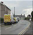
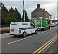
Two Highway Maintenance vans, Pillmawr Road, Malpas, Newport
A large van and a smaller van are parked near speed bumps in July 2021.
The Three Horseshoes pub is in the background.
Image: © Jaggery
Taken: 7 Jul 2021
0.01 miles
8
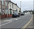
Two vehicles, Pillmawr Road, Malpas, Newport
Brandwells Construction van 320 is behind an Asda home delivery van in August 2023.
Image: © Jaggery
Taken: 29 Aug 2023
0.01 miles
9
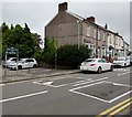
English / Welsh text painted on Pillmawr Road, Malpas, Newport
SLOW / ARAF are on Pillmawr Road on the approach to the T junction opposite the Three Horseshoes pub in the background.
Image: © Jaggery
Taken: 30 Jul 2022
0.01 miles
10
Morrisons home delivery van, Pillmawr Road, Malpas, Newport
Image: © Jaggery
Taken: 14 Oct 2018
0.01 miles


