1
Partly-cleared roadway, Harding Avenue, Malpas, Newport
Looking along Harding Avenue past the entrance to St Joseph's Hospital http://www.geograph.org.uk/photo/3331759 towards Almond Drive.
Image: © Jaggery
Taken: 20 Jan 2013
0.01 miles
2
Almond Drive semis, Newport
Semi-detached houses on the south side Almond Drive in the Malpas area of Newport.
Ahead for the A4051 Malpas Road.
Image: © Jaggery
Taken: 5 Jul 2020
0.01 miles
3
Dark green cabinet, Almond Drive, Newport
Telecoms cabinet on the south side of Almond Drive west of Wistaria Close in the Malpas area of Newport.
Image: © Jaggery
Taken: 18 Jun 2021
0.01 miles
4
Junction of Harding Avenue and Almond Drive, Malpas, Newport
The 30mph speed limit drops to 20mph on the approach to Malpas Park Primary School.
Image: © Jaggery
Taken: 8 Jan 2016
0.01 miles
5
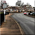
Reduced speed limit, Harding Avenue, Malpas, Newport
Viewed in April 2021. The 30mph speed limit along Harding Avenue was reduced to 20mph last month.
Image: © Jaggery
Taken: 24 Apr 2021
0.01 miles
6
Junction of Harding Avenue and Almond Drive, Malpas, Newport
From the left, Harding Avenue joins Almond Drive.
Image: © Jaggery
Taken: 24 Apr 2021
0.01 miles
7
Junction of Almond Drive and Harding Avenue, Malpas, Newport
Turn left into Harding Avenue for St Joseph's Hospital (Ysbyty St Joseph in Welsh).
Image: © Jaggery
Taken: 18 Jun 2021
0.01 miles
8
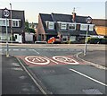
20 times 4, Harding Avenue, Malpas, Newport
At the Almond Drive junction viewed in July 2022.
The upside-down 20 used to be an upside-down 30.
Image: © Jaggery
Taken: 16 Jul 2022
0.01 miles
9
20mph speed limit past Malpas Park Primary School in Newport
The school perimeter railings are on the left. The grey back of a vehicle speed indicator http://www.geograph.org.uk/photo/4358842 is below the 20 sign.
Image: © Jaggery
Taken: 7 Feb 2015
0.02 miles
10
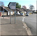
Bilingual direction sign, Almond Drive, Malpas, Newport
The black arrow on the sign points towards Harding Avenue and St Joseph's Hospital (Ysbyty St Joseph in Welsh).
Image: © Jaggery
Taken: 24 Apr 2021
0.02 miles


