1
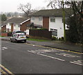
Westfield Drive houses, Malpas, Newport
Houses on the north side Westfield Drive near the corner of Malpas Road behind the camera.
Image: © Jaggery
Taken: 1 Jan 2020
0.01 miles
2
Westfield Drive semis, Malpas, Newport
Semi-detached houses on the north side of Westfield Drive viewed from the corner of Malpas Road.
Image: © Jaggery
Taken: 28 Jul 2017
0.01 miles
3
Danger of Death - Keep Off, Malpas, Newport
"Danger of Death - Keep Off" and the Welsh equivalent are on the yellow notice on the green cabinet in March 2022. SOUTH WALES ELECTRICITY BOARD is embossed on the cabinet. One of 12 Area Boards created under the terms of the Electricity Act 1947 which nationalised the more than 600 electric power companies in the UK, the South Wales Electricity Board was renamed SWALEC (South Wales Electricity) in 1990.
Image: © Jaggery
Taken: 15 Mar 2022
0.01 miles
4
Westfield Drive bus stop and shelter, Malpas, Newport
This stop below Malpas Road is part of Newport Bus Route 19 in September 2017.
There is no bus route in the opposite direction here.
Image: © Jaggery
Taken: 16 Sep 2017
0.02 miles
5
No Sunday buses here until further notice, Westfield Drive, Newport
Viewed on Sunday May 3rd 2020. The temporary Newport Bus timetables in use during the Coronavirus (COVID-19) pandemic give all routes severely reduced frequencies six days a week and no buses anywhere in the city on Sundays.
Image: © Jaggery
Taken: 3 May 2020
0.02 miles
6
New minimalist bus shelter, Westfield Drive, Newport
Viewed in October 2022. This shelter with no protection from wind-blown rain or snow has replaced the one seen here https://www.geograph.org.uk/photo/6466788 in May 2020.
Image: © Jaggery
Taken: 7 Oct 2022
0.02 miles
7
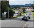
Westfield Drive after the Snow
Westfield Drive after February 2009's snow. The distant fields still appear white, but Twm Barlwm mountain is hidden by clouds today.
Image: © David Roberts
Taken: 3 Feb 2009
0.02 miles
8
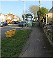
Yellow and green, Westfield Drive, Malpas, Newport
Yellow salt/grit box and green bus shelter on the south side of Westfield Drive on the ascent towards the A4051 Malpas Road.
Image: © Jaggery
Taken: 12 Feb 2021
0.02 miles
9
TO LET board on a Malpas corner, Newport
Paul Fosh Lettings board on the corner of Westfield Drive and Westfield Avenue in October 2022.
Image: © Jaggery
Taken: 7 Oct 2022
0.02 miles
10
Westfield Gardens, Malpas, Newport
Westfield Gardens is a development of houses and apartments, built c2007. It runs parallel with Malpas Road. This view is from the far end.
The venerable oak is probably several centuries old.
Image: © Jaggery
Taken: 8 Mar 2010
0.02 miles


