1
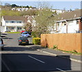
Walnut Drive, Caerleon
Image: © Roger Cornfoot
Taken: 11 Apr 2007
0.02 miles
2
Walnut Drive, Caerleon
A cul-de-sac near the southwest edge of housing in Caerleon. Viewed across Roman Reach from the corner of Wentwood Road.
Image: © Jaggery
Taken: 5 Apr 2010
0.03 miles
3
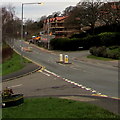
Hazel Walk, Caerleon
Looking along Hazel Walk from the corner of Roman Reach.
Image: © Jaggery
Taken: 17 Apr 2010
0.04 miles
4
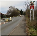
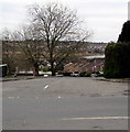
Plane Tree Close, Caerleon
Viewed from the corner of Roman Reach.
Image: © Jaggery
Taken: 14 Jun 2010
0.04 miles
5
Unsuitable route for HGVs 100 yards ahead, Lodge Road, Caerleon
At the western end of Lodge Road, near the Trinity View junction.
100 yards ahead, Pillmawr Road towards the Malpas area of Newport
is unsuitable for heavy goods vehicles. The text is also in Welsh.
Image: © Jaggery
Taken: 31 Dec 2018
0.04 miles
6
Lodge Road house construction site near Trinity View, Caerleon
Viewed on December 31st 2018. A March 2017 Google Street View
shows a fenced-off site being prepared for construction.
Image: © Jaggery
Taken: 31 Dec 2018
0.05 miles
7
Dark green cabinets on a suburban corner of Caerleon
Telecoms cabinets on the corner of Pillmawr Road and Roman Reach.
Image: © Jaggery
Taken: 31 Dec 2018
0.05 miles
8
West along Lodge Road, Caerleon
Towards Pillmawr Road and the Malpas area of Newport. The Roman Reach junction is on the left.
A house construction site https://www.geograph.org.uk/photo/6015744 is on the right.
Image: © Jaggery
Taken: 31 Dec 2018
0.05 miles
9
Reduce Speed Now, Pillmawr Road, Caerleon
Pillmawr Road narrows ahead on the route to the Malpas area of Newport.
Image: © Jaggery
Taken: 31 Dec 2018
0.05 miles
10
Junction of Pillmawr Road and Roman Reach, Caerleon
Roman Reach descends away from Pillmawr Road.
A muddy bank of the tidal River Usk is in the background.
Image: © Jaggery
Taken: 31 Dec 2018
0.05 miles


