IMAGES TAKEN NEAR TO
Meadow Lane, NOTTINGHAM, NG10 2FQ

Introduction

This page details the photographs taken nearby to Meadow Lane, NG10 2FQ by members of the Geograph project.

The Geograph project started in 2005 with the aim of publishing, organising and preserving representative images for every square kilometre of Great Britain, Ireland and the Isle of Man.

There are currently over 7.5m images from over14,400 individuals and you can help contribute to the project by visiting https://www.geograph.org.uk

Image Map


Images are licensed for reuse under creativecommons.org/licenses/by-sa/2.0
Notes
  • Clicking on the map will re-center to the selected point.
  • The higher the marker number, the further away the image location is from the centre of the postcode.

Image Listing (91 Images Found)

Images are licensed for reuse under creativecommons.org/licenses/by-sa/2.0
  • ...
Image
Details
Distance
1
Meadow Lane allotments
The main entrance off Meadow Lane.
Image: © Alan Murray-Rust Taken: 21 Jun 2009
0.04 miles
2
Meadow Lane Long Eaton
Image: © Andy Jamieson Taken: 24 Dec 2008
0.06 miles
3
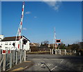
Meadow Lane crossing
Crossing the main line to Nottingham.
Image: © Alan Murray-Rust Taken: 21 Jun 2009
0.06 miles
4
Level Crossing Long Eaton
Image: © Roy Hughes Taken: 1 Dec 2012
0.06 miles
5
Meadow Lane level crossing, Long Eaton (1)
Looking from Meadow Lane towards Long Eaton town centre.
Image: © Richard Vince Taken: 17 Aug 2015
0.07 miles
6
Meadow Lane level crossing, Long Eaton (2)
Seen from the end of Trent Lane. Note the additional level crossing lights for traffic from Trent Lane.
Image: © Richard Vince Taken: 17 Aug 2015
0.07 miles
7
Meadow Lane Crossing, Long Eaton, Derbys.
The shadow cast by a solitary street lamp on Trent Lane marks the junction of Trent Lane with Meadow Lane. Traffic turning to the left and crossing the level crossing will quickly end up joining or crossing Station Road in the town centre. A 20 minute walk behind the photographer however, can take walkers as far as Cranfleet Farm and beyond that to the Cranfleet Canal that joins the River Trent near Trentlock.
Image: © David Hallam-Jones Taken: 17 Feb 2013
0.07 miles
8
Long Eaton 1st railway station (site), Derbyshire
Opened as "Long Eaton" in 1839 by the Midland Counties Railway, later part of the Midland Railway, on the lines from Derby and Leicester to Nottingham, this station was renamed "Long Eaton Junction" in 1847 following the opening of another "Long Eaton" - see Image This one closed in 1862, whilst the other closed in 1863, as a third "Long Eaton" opened on Station Street - see Image View north east towards Attenborough and Nottingham. No trace of this station apparently remains.
Image: © Nigel Thompson Taken: 26 Mar 2022
0.07 miles
9
Meadow Lane level crossing, Long Eaton
A Cross-Country train consisting of a class 170 diesel unit heads towards Nottingham.
Image: © Alan Murray-Rust Taken: 8 Jul 2022
0.07 miles
10
New Gates
The end of Meadow Lane - the entrance to Trent Meadows - is currently gated. This is for Severn Trent Water engineering to lay a new discharge pipeline from the Toton treatment works to the Trent. Pasture Lane on the right is unaffected.
Image: © David Lally Taken: 3 Mar 2024
0.07 miles
  • ...