IMAGES TAKEN NEAR TO
Harehills Avenue, NEWCASTLE UPON TYNE, NE5 3HE
Introduction
This page details the photographs taken nearby to Harehills Avenue, NE5 3HE by members of the Geograph project.
The Geograph project started in 2005 with the aim of publishing, organising and preserving representative images for every square kilometre of Great Britain, Ireland and the Isle of Man.

There are currently over 7.5m images from over14,400 individuals and you can help contribute to the project by visiting https://www.geograph.org.uk
Image Map (Loading...)


Getting Data...Please wait
Leaflet Map data © OpenStreetMap
Images are licensed for reuse under creativecommons.org/licenses/by-sa/2.0
Notes
- Clicking on the map will re-center to the selected point.
- The higher the marker number, the further away the image location is from the centre of the postcode.
Image Listing (15 Images Found)
Images are licensed for reuse under creativecommons.org/licenses/by-sa/2.0
Image
Details
Distance
2
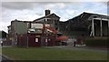
Demolition of Cowgate Leisure Centre
The building was originally Montague Baths, opened in the early Sixties. It was converted into a leisure centre during the mid Eighthies.
Image: © Anthony Foster
Taken: 13 Jun 2009
0.06 miles
3
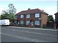
Rumana Indian Restaurant
Originally a private dwelling the building was converted into a pub - The Cooper's Forge - in the early Eighties. It assumed its present form around the turn of the Millennium
Image: © Anthony Foster
Taken: 13 Jun 2009
0.12 miles
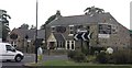
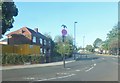
5
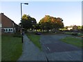
Penshaw Green
A fine evening and there were quite a few folk about.
Image: © Richard Webb
Taken: 1 Oct 2015
0.15 miles
6
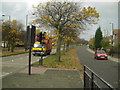
Ponteland Road
This Road takes one to Newcastle Airport.
Image: © MSX
Taken: 29 Oct 2005
0.16 miles
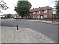
7
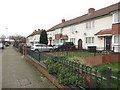
Houses, Eastern Way, Cowgate
A line of terraced houses on Eastern Way in the Cowgate estate in Newcastle.
Image: © Graham Robson
Taken: 10 Feb 2018
0.16 miles
8
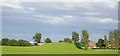
Blakelaw sports field/park
Hill (man made) on local sports field. Believed to be the spill from when the estate was built.
Image: © Newbiggin Hall Scouts
Taken: 7 Jul 2007
0.18 miles
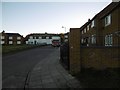
9
Eastern Way
Residential street in the northwestern suburbs of Newcastle.
Image: © Barbara Carr
Taken: 15 Sep 2013
0.18 miles
10
Eastern Way, Cowgate, Newcastle upon Tyne
A residential street in the Cowgate area of Newcastle.
Image: © Graham Robson
Taken: 6 Jul 2020
0.18 miles