IMAGES TAKEN NEAR TO
Strathyre Gardens, AIRDRIE, ML6 0QD

Introduction

This page details the photographs taken nearby to Strathyre Gardens, ML6 0QD by members of the Geograph project.

The Geograph project started in 2005 with the aim of publishing, organising and preserving representative images for every square kilometre of Great Britain, Ireland and the Isle of Man.

There are currently over 7.5m images from over14,400 individuals and you can help contribute to the project by visiting https://www.geograph.org.uk

Image Map


Images are licensed for reuse under creativecommons.org/licenses/by-sa/2.0
Notes
  • Clicking on the map will re-center to the selected point.
  • The higher the marker number, the further away the image location is from the centre of the postcode.

Image Listing (9 Images Found)

Images are licensed for reuse under creativecommons.org/licenses/by-sa/2.0
Image
Details
Distance
1
Crathie Drive, New Monklands
Image: © Elliott Simpson Taken: 7 Feb 2013
0.02 miles
2
Entering Glenmavis
Looking south west on Raebog Road (B803).
Image: © JThomas Taken: 29 Jun 2017
0.05 miles
3
Lawn mowing, Glenmavis
Mowing an open space between Crathie Drive and Raebor Road. There is an election poster on a lamp post. Elections here are not competitive, it is a safe seat.
Image: © Richard Webb Taken: 20 Apr 2010
0.12 miles
4
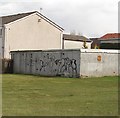
Garages, Balmoral Avenue
Garages and an open space, Glenmavis.
Image: © Richard Webb Taken: 20 Apr 2010
0.14 miles
5
Old hedgerow
Boundary between a public open space and some rough farmland by Windsor Drive, Glenmavis.
Image: © Richard Webb Taken: 20 Apr 2010
0.16 miles
6
Looking north east on the Raebog Road
As it heads towards its junction with the A73 in Airdrie.
Image: © James Denham Taken: 20 Apr 2013
0.22 miles
7
Albert Bartlett Potato Facility, New Monkland, Airdrie
£30m recent development. http://www.albert-bartlett.co.uk
Image: © Chris Upson Taken: 20 Aug 2006
0.24 miles
8
Grassland, Raebog
Off Raebog Road (B803).
Image: © JThomas Taken: 29 Jun 2017
0.24 miles
9
Stand, Laverock Knowe
Track to worked out coal recovery (open cast) quarry.
Image: © Robert Murray Taken: 26 Jul 2011
0.24 miles