IMAGES TAKEN NEAR TO
Manchester Road, MANCHESTER, M27 4FB

Introduction

This page details the photographs taken nearby to Manchester Road, M27 4FB by members of the Geograph project.

The Geograph project started in 2005 with the aim of publishing, organising and preserving representative images for every square kilometre of Great Britain, Ireland and the Isle of Man.

There are currently over 7.5m images from over14,400 individuals and you can help contribute to the project by visiting https://www.geograph.org.uk

Image Map


Images are licensed for reuse under creativecommons.org/licenses/by-sa/2.0
Notes
  • Clicking on the map will re-center to the selected point.
  • The higher the marker number, the further away the image location is from the centre of the postcode.

Image Listing (14 Images Found)

Images are licensed for reuse under creativecommons.org/licenses/by-sa/2.0
Image
Details
Distance
1
Old Milestone by the A572, Swinton
Carved stone post by the A572, in parish of Salford (Salford District), buried in the pavement, by brick wall on South side of road. St Helens stone, erected by the Bolton & St Helens turnpike trust in the 19th century. Inscription once read:- SWINTON TO MANCHESTER 4 MILES TO LEIGH 9 MILES Milestone Society National ID: LA_MCLH04.
Image: © Debbie Williams Taken: 6 Oct 2024
0.02 miles
2
Victoria Park Games Hut, Swinton
Image: © David Dixon Taken: 9 Oct 2010
0.12 miles
3
I do!
Salford Register Office, Barton Road, Pendlebury. Pictured in 2005. In 2007 the Register Office was closed and relocated when nearby demolition work broke through into an old mineral line railway tunnel (the "Black Harry Tunnel", constructed 1847). In 1953 five people lost their lives in a nearby street when a long covered ventilation shaft belonging to this tunnel collapsed and two houses fell into the hole.
Image: © Keith Williamson Taken: 5 Sep 2005
0.13 miles
4
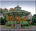
Victoria Park Bandstand, Swinton
Image: © David Dixon Taken: 9 Oct 2010
0.13 miles
5
Victoria Park Bandstand
This Bandstand was erected by public subscription and presented to the district to commemorate the sixtieth year of the reign of Queen Victoria in June 1897 and was refurbished by Salford City Council in 2005.
Image: © Edward Smith Taken: 22 Oct 2009
0.14 miles
6
Victoria Park opposite Barton Road
Image: © Ian Greig Taken: 21 Sep 2010
0.16 miles
7
Victoria Park, Swinton
Image: © David Dixon Taken: 9 Oct 2010
0.16 miles
8
Farmers Arms
The Farmers Arms public house, on Manchester Road (the A6) at Swinton.
Image: © David Dixon Taken: 9 Oct 2010
0.18 miles
9
Farmers Arms, Swinton
The Farmers Arms public house on Manchester Road (the A6).
Image: © David Dixon Taken: 9 Oct 2010
0.18 miles
10
Victoria Park, Swinton
Image: © David Dixon Taken: 9 Oct 2010
0.20 miles