IMAGES TAKEN NEAR TO
Church Farm Close, LEICESTER, LE9 1RW

Introduction

This page details the photographs taken nearby to Church Farm Close, LE9 1RW by members of the Geograph project.

The Geograph project started in 2005 with the aim of publishing, organising and preserving representative images for every square kilometre of Great Britain, Ireland and the Isle of Man.

There are currently over 7.5m images from over14,400 individuals and you can help contribute to the project by visiting https://www.geograph.org.uk

Image Map


Images are licensed for reuse under creativecommons.org/licenses/by-sa/2.0
Notes
  • Clicking on the map will re-center to the selected point.
  • The higher the marker number, the further away the image location is from the centre of the postcode.

Image Listing (56 Images Found)

Images are licensed for reuse under creativecommons.org/licenses/by-sa/2.0
  • ...
Image
Details
Distance
1
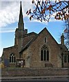
Saint Michael and All Angels church, Cosby
Image: © Mat Fascione Taken: 16 Nov 2017
0.03 miles
2
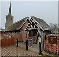
Cosby Church
Saint Michael and All Angels, looking from the public footpath through an industrial premises.
Image: © Ian Rob Taken: 28 May 2011
0.03 miles
3
The Tithe Barn in Cosby
The Tithe Barn, a grade II listed building, dates back to about 1450, where it was once used as one of the many granaries within the Leicester Abbey parish. It is now used as a Deli Cafe. It is situated next to Saint Michael and All Angels church.
Image: © Mat Fascione Taken: 3 Mar 2021
0.04 miles
4
Saint Michael and All Angels church, Cosby
Image: © Mat Fascione Taken: 16 Nov 2017
0.04 miles
5
Saint Michael and All Angels church, Cosby
Image: © Mat Fascione Taken: 26 Oct 2017
0.04 miles
6
St. Michael and All Angels', Cosby
Image: © Mat Fascione Taken: 28 Jul 2007
0.04 miles
7
Saint Michael and All Angels church
Image: © Tim Glover Taken: 9 Jul 2018
0.04 miles
8
Benchmark on Cosby church tower
This bench mark was established in 1856 during the First primary levelling of England & Wales, and was levelled with a height of 247.0180 feet [75.2911 metres] above mean sea level (Liverpool datum). It was included on the Coventry to Lincoln levelling line. The surveyor's description was "No. 39. Bolt in North-east angle of Cosby Church tower ; 2.54 ft. above surface" (Public Abstract p.327). The mark is actually at the north-west corner of the tower.
Image: © Shantavira Taken: 30 May 2015
0.05 miles
9
The Blacksmiths Arms
Public House on Main Street in Cosby, Leicestershire.
Image: © Mat Fascione Taken: 28 Jul 2007
0.06 miles
10
Footbridge across Cosby Brook, Cosby
Image: © Mat Fascione Taken: 15 Feb 2017
0.06 miles
  • ...