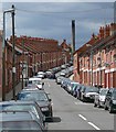
IMAGES TAKEN NEAR TO
Rowsley Avenue, LEICESTER, LE5 5BR

Introduction

This page details the photographs taken nearby to Rowsley Avenue, LE5 5BR by members of the Geograph project.

The Geograph project started in 2005 with the aim of publishing, organising and preserving representative images for every square kilometre of Great Britain, Ireland and the Isle of Man.

There are currently over 7.5m images from over14,400 individuals and you can help contribute to the project by visiting https://www.geograph.org.uk

Image Map


Images are licensed for reuse under creativecommons.org/licenses/by-sa/2.0
Notes
  • Clicking on the map will re-center to the selected point.
  • The higher the marker number, the further away the image location is from the centre of the postcode.

Image Listing (32 Images Found)

Images are licensed for reuse under creativecommons.org/licenses/by-sa/2.0
  • ...
Image
Details
Distance
1
Benchmark on #372 East Park Road
Ordnance Survey cut mark benchmark described on the Bench Mark Database at http://www.bench-marks.org.uk/bm84471
Image: © Roger Templeman Taken: 5 May 2017
0.10 miles
2
Imam Muhammad Adam Institute, #372 East Park Road
There is an OS benchmark Image on the wall of the building beside the bottom steep
Image: © Roger Templeman Taken: 5 May 2017
0.10 miles
3
Fara House, Leicester
Now a solicitors on East Park Road.
Image: © JThomas Taken: 31 May 2014
0.10 miles
4
Former Evington Cinema
The 'Evo' was opened in 1916, but destroyed by arsonist fire in 1984 https://www.leicestermercury.co.uk/news/history/rise-fall-evingtons-cinema-855351. The front of the building is now occupied by a company of solicitors.
Image: © Tim Heaton Taken: 6 Oct 2020
0.10 miles
5
Cork Street, Highfields
Off East Park Road.
Image: © Richard Vince Taken: 9 Mar 2024
0.12 miles
6
Fairfield Street, Highfields
Off East Park Road.
Image: © Richard Vince Taken: 9 Mar 2024
0.14 miles
7
The old Evington Cinema
The corner of East Park Road and Chesterfield Road.
Image: © Mat Fascione Taken: 17 Jun 2007
0.14 miles
8
Dronfield Street, Highfields
Off East Park Road.
Image: © Richard Vince Taken: 9 Mar 2024
0.14 miles
9
Fairfield Street, Highfields
Image: © Mat Fascione Taken: 17 Jun 2007
0.15 miles
10
Spinney Hill Park, Highfields
Looking into the park from Park Vale Road, which forms its southern boundary.
Image: © Richard Vince Taken: 9 Mar 2024
0.18 miles
  • ...