1
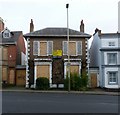
Benchmark on #57 Skipworth Street
Ordnance Survey cut mark benchmark described on the Bench Mark Database at http://www.bench-marks.org.uk/bm84485
Image: © Roger Templeman
Taken: 5 May 2017
0.04 miles
2
Houses on Skipworth Street
There is an OS benchmark
Image in the bricks to the right of the woman in a doorway
Image: © Roger Templeman
Taken: 5 May 2017
0.04 miles
3
No. 63 Hamilton Street at Evington Road junction
Ordnance Survey documents indicate that in 1965 a benchmark levelled at 87.2225 was verified on the corner, left hand face, of the boundary wall, sections of which have been rebuilt.
Image: © phil Richards
Taken: 9 Sep 2017
0.06 miles
4
Skipworth and Medway Streets in Highfields, Leicester
Image: © Mat Fascione
Taken: 4 Sep 2020
0.10 miles
5
Evington Footway, Leicester
Originally a rural footpath to the village of Evington, the urban end has survived the 19th and 20th century development of the City. It has even been provided with proper cast-iron name signs.
Image: © Alan Murray-Rust
Taken: 26 Jan 2019
0.11 miles
6
Benchmark on #44 Myrtle Road
Ordnance Survey cut mark benchmark described on the Bench Mark Database at http://www.bench-marks.org.uk/bm84483
Image: © Roger Templeman
Taken: 5 May 2017
0.11 miles
7
Houses on Myrtle Road
There is an OS benchmark
Image left of the right hand door
Image: © Roger Templeman
Taken: 5 May 2017
0.11 miles
8
Victoria House, 172/174 London Road
Original a pair of early 19th century houses, Regency style, Listed Grade II.
Image: © Alan Murray-Rust
Taken: 26 Jan 2019
0.11 miles
9
170 London Road, Leicester
Early 19th century, Regency style house, Listed Grade II. Looking sorry for itself at the time of my visit.
Image: © Alan Murray-Rust
Taken: 26 Jan 2019
0.11 miles
10
Medway Community Primary School at Skipworth Street/St Stephens Road junction
See http://www.bench-marks.org.uk/bm84482 for details of benchmark on the near corner of the school
Image: © Roger Templeman
Taken: 5 May 2017
0.12 miles


