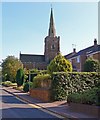
IMAGES TAKEN NEAR TO
Church Lane, MELTON MOWBRAY, LE14 2PS

Introduction

This page details the photographs taken nearby to Church Lane, LE14 2PS by members of the Geograph project.

The Geograph project started in 2005 with the aim of publishing, organising and preserving representative images for every square kilometre of Great Britain, Ireland and the Isle of Man.

There are currently over 7.5m images from over14,400 individuals and you can help contribute to the project by visiting https://www.geograph.org.uk

Image Map


Images are licensed for reuse under creativecommons.org/licenses/by-sa/2.0
Notes
  • Clicking on the map will re-center to the selected point.
  • The higher the marker number, the further away the image location is from the centre of the postcode.

Image Listing (45 Images Found)

Images are licensed for reuse under creativecommons.org/licenses/by-sa/2.0
  • ...
Image
Details
Distance
1
Church Lane, Somerby
The centre of Somerby has a very closed-in feeling reminiscent of Pennine villages.
Image: © Jonathan Thacker Taken: 2 Dec 2021
0.01 miles
2
Somerby: Southfields Farm
Ironstone walls and deep shadows in Church Lane on a bright October morning.
Image: © John Sutton Taken: 4 Oct 2012
0.01 miles
3
All Saints church at Somerby
Image: © Mat Fascione Taken: 25 Nov 2017
0.03 miles
4
In Somerby churchyard
Slate, ironstone and autumn sunlight.
Image: © John Sutton Taken: 4 Oct 2012
0.04 miles
5
Somerby, Leics - All Saints Church
Image: © Colin Park Taken: 16 May 2018
0.04 miles
6
All Saints Church
Many of the headstones are of Leicestershire slate
Image: © Roger Templeman Taken: 21 Apr 2014
0.04 miles
7
Church of All Saints, Somerby
12th century origins, with a central tower. The ironstone is heavily weathered (in common with many churches in the area)
Image: © Tim Heaton Taken: 21 Aug 2018
0.04 miles
8
All Saints Church, Somerby. Leicestershire
Image: © Mat Fascione Taken: 4 Aug 2007
0.04 miles
9
Somerby spire
The spire of All Saints' church dates from around 1300.
Image: © John Sutton Taken: 4 Oct 2012
0.04 miles
10
All Saints Church
The spire is an Ordnance Survey intersected station trig point, http://www.trigpointinguk.com/trigs/trig-details.php?t=10709
Image: © Roger Templeman Taken: 21 Apr 2014
0.04 miles
  • ...