1
Mid-Wales train for Moat Lane leaving Brecon
View SW, towards Brecon Station: ex-GWR, former Brecon & Merthyr line to Newport, from which this train will diverge at Talyllyn Junction onto the former Cambrian line via Builth Wells to Moat Lane Junction. By 1962 the LMS Ivatt 2MT 2-6-0s are dominating the traffic on these lines: this is No. 46522 (built 3/53, withdrawn 5/67) on the 17.05 from Brecon.
Image: © Ben Brooksbank
Taken: 15 Jun 1962
0.05 miles
2
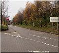
Camden Road, 1
Residential road on the south-eastern approach to Brecon.
The photographer lived in the first house from the right in 1995/96.
Image: © Jonathan Billinger
Taken: 7 Mar 2018
0.07 miles
3
Ordnance Survey Cut Mark
This OS cut mark can be found on the wall post of The Friars, Camden Road. It marks a point 152.275m above mean sea level.
Image: © Adrian Dust
Taken: 16 Aug 2022
0.07 miles
4
Camden Road, 2
Looking towards the town centre.
Image: © Jonathan Billinger
Taken: 7 Mar 2018
0.08 miles
5
Powys County Council offices, Brecon
The southeast side of council offices south of Camden Road.
Image: © Jaggery
Taken: 24 Nov 2019
0.10 miles
6
Council Offices, Brecon
Powys County Council's Brecknockshire offices are located at the western end of Cambrian Close.
Image: © Jaggery
Taken: 10 Jul 2011
0.10 miles
7
Powys County Council office and van, Brecon
Located in Cambrian Way, Neuadd Brycheiniog is Powys council's Brecon office.
Image: © Jaggery
Taken: 18 Aug 2013
0.10 miles
8
No Entry sign near Powys County Council offices, Brecon
Part of a triangular one-way system on the southeast side of the offices. https://www.geograph.org.uk/photo/6420143
Image: © Jaggery
Taken: 24 Nov 2019
0.10 miles
9
Ordnance Survey Cut Mark
This OS cut mark can be found on the wall post of The Laurels, Camden Road. It marks a point 149.602m above mean sea level.
Image: © Adrian Dust
Taken: 16 Aug 2022
0.11 miles
10
Powys highway maintenance vans, Brecon
Parked near Powys County Council offices in November 2019.
Image: © Jaggery
Taken: 24 Nov 2019
0.11 miles


