IMAGES TAKEN NEAR TO
BUILTH WELLS, LD2 3LX

Introduction

This page details the photographs taken nearby to LD2 3LX by members of the Geograph project.

The Geograph project started in 2005 with the aim of publishing, organising and preserving representative images for every square kilometre of Great Britain, Ireland and the Isle of Man.

There are currently over 7.5m images from over14,400 individuals and you can help contribute to the project by visiting https://www.geograph.org.uk

Image Map


Images are licensed for reuse under creativecommons.org/licenses/by-sa/2.0
Notes
  • Clicking on the map will re-center to the selected point.
  • The higher the marker number, the further away the image location is from the centre of the postcode.

Image Listing (6 Images Found)

Images are licensed for reuse under creativecommons.org/licenses/by-sa/2.0
Image
Details
Distance
1
Above the Wye
From a minor road in the west of the square. An enclosed moorland area, drops towards the Wye. As the slope steepens it gives way to Henallt woodland seen to the right in the square.
Image: © Graham Horn Taken: 24 Jan 2008
0.12 miles
2
Above the Wye
Unkempt land above Henallt woods that lead down to the Wye valley.
Image: © Graham Horn Taken: 24 Jan 2008
0.18 miles
3
Wye Valley Walk - path continues up-hill
The route is generally well signed - the next can already be seen up on the skyline.
Image: © Andrew Hill Taken: 12 May 2018
0.21 miles
4
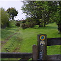
Wye Valley Walk - footpath and view
Looking down a section just below the open hill.
Image: © Andrew Hill Taken: 12 May 2018
0.22 miles
5
On part of the Wye Valley Walk above Pantypwllau farm
Squalls scud by behind us at Builth. But we have not felt a single drop of rain yet this morning, despite it being forecast. The sun shines on the righteous.
Image: © Jeremy Bolwell Taken: 3 Jul 2024
0.24 miles
6
The Wye Valley Walk climbs to Banc y Celyn
Image: © David Purchase Taken: 12 May 2012
0.25 miles