1
Bridleway and footpath, Llanddewi Ystradenni, Powys
The bridleway and footpath head east away from the main road through the village.
Image: © Jaggery
Taken: 18 Aug 2013
0.02 miles
2
Bus shelter, Llanddewi Ystradenni, Powys
The bus shelter is alongside TrawsCymru bus route T4 from Newtown to Cardiff. Today, a Sunday, there is only one bus each way, starting from Merthyr Tydfil in the morning and returning from Newtown in the afternoon. On weekdays there are 7 buses each way, at about 2-hourly intervals. Some start at Cardiff, others at Merthyr Tydfil. The northern terminus for all is Newtown.
Image: © Jaggery
Taken: 18 Aug 2013
0.05 miles
3
Northern entry to Llanddewi Ystradenni, Powys
Viewed across the A483. The road ahead, the main road through the village,
rejoins the A483 400 metres to the south.
Image: © Jaggery
Taken: 18 Aug 2013
0.06 miles
4
A483 skirts the western edge of Llanddewi Ystradenni, Powys
The village is about 9km NE of Llandrindod Wells. This view is looking NNE.
Image: © Jaggery
Taken: 18 Aug 2013
0.06 miles
5
Houses alongside the A483 in Llanddewi Ystradenni, Powys
The A483 skirts the western edge of the village.
Image: © Jaggery
Taken: 18 Aug 2013
0.06 miles
6
A483 passes the northern turning for Llanddewi Ystradenni, Powys
The main residential area of Llanddewi is on the east side of the A483.
The left turn is for the road through the village. The road rejoins the A483 400 metres to the south. Signs alongside the A483 point south towards Llandrindod Wells, north for Newtown. The sign pointing towards Llanddewi also shows Dolau 2½ (miles).
Image: © Jaggery
Taken: 18 Aug 2013
0.07 miles
7
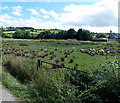
Rough grazing, Llanddewi Ystradenni, Powys
Viewed from a bridleway and footpath. http://www.geograph.org.uk/photo/3608486
Image: © Jaggery
Taken: 18 Aug 2013
0.07 miles
8
Dan-y-gaer houses, Llanddewi Ystradenni, Powys
Viewed across the A483.
Image: © Jaggery
Taken: 18 Aug 2013
0.09 miles
9
Pond, Llanddewi Ystradenni, Powys
Located about 70 metres east of the village church, http://www.geograph.org.uk/photo/3608201
the roughly rectangular pond measures about 35 metres by 30 metres.
Image: © Jaggery
Taken: 18 Aug 2013
0.10 miles
10
Weale's Wheels, Llanddewi
Coach hire company depot in Llanddewi Ystradenni, about 9km NE of Llandrindod Wells.
Image: © Jaggery
Taken: 18 Aug 2013
0.10 miles


