IMAGES TAKEN NEAR TO
Mount Pleasant, WEYBRIDGE, KT13 8EP

Introduction

This page details the photographs taken nearby to Mount Pleasant, KT13 8EP by members of the Geograph project.

The Geograph project started in 2005 with the aim of publishing, organising and preserving representative images for every square kilometre of Great Britain, Ireland and the Isle of Man.

There are currently over 7.5m images from over14,400 individuals and you can help contribute to the project by visiting https://www.geograph.org.uk

Image Map


Images are licensed for reuse under creativecommons.org/licenses/by-sa/2.0
Notes
  • Clicking on the map will re-center to the selected point.
  • The higher the marker number, the further away the image location is from the centre of the postcode.

Image Listing (60 Images Found)

Images are licensed for reuse under creativecommons.org/licenses/by-sa/2.0
  • ...
Image
Details
Distance
1
Portmore Park Road - Weybridge
Image: © James Emmans Taken: 10 May 2016
0.06 miles
2
Radnor Road Weybridge
Old terrace houses built originally for the poor families. Now a sought after location with gardens on right side of street backing onto the River Wey.
Image: © James Emmans Taken: 8 Jul 2014
0.11 miles
3
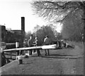
Thames Lock, Weybridge
This is the final lock in the descent of the River Wey to reach the Thames.
Image: © Dr Neil Clifton Taken: 16 Apr 1984
0.11 miles
4
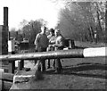
Above Thames Lock, Wey Navigation, Surrey
The lock keeper gives some useful pointers as this is a difficult lock.
Image: © Dr Neil Clifton Taken: 16 Apr 1984
0.11 miles
5
Above Thames Lock, Wey Navigation, Surrey
Looking upstream along the navigation.
Image: © Dr Neil Clifton Taken: 16 Apr 1984
0.11 miles
6
Thames Lock, Weybridge
The lock keeper (right in the picture) could be irascible if not approached with due respect.
Image: © Dr Neil Clifton Taken: 16 Apr 1984
0.12 miles
7
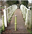
Footbridge over River Wey at Weybridge
This leads from Jessamy Road / Church Walk to Whittet's Ait and is on the route of the London Green Belt Way.
Image: © Sean Davis Taken: 23 Jan 2007
0.12 miles
8
Lincoln Grove, Weybridge
Image: © Alex McGregor Taken: 10 Jun 2011
0.13 miles
9
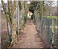
Path across Whittet's Ait
This enclosed footpath leads to a footbridge over the River Wey to Jessamy Road / Church Walk. It is on the route of the London Green Belt Way.
Image: © Sean Davis Taken: 23 Jan 2007
0.13 miles
10
River Wey Lock
Image: © Alan Morrison Taken: 31 Mar 2001
0.14 miles
  • ...