IMAGES TAKEN NEAR TO
Upper Fountain Street, SOWERBY BRIDGE, HX6 2QY

Introduction

This page details the photographs taken nearby to Upper Fountain Street, HX6 2QY by members of the Geograph project.

The Geograph project started in 2005 with the aim of publishing, organising and preserving representative images for every square kilometre of Great Britain, Ireland and the Isle of Man.

There are currently over 7.5m images from over14,400 individuals and you can help contribute to the project by visiting https://www.geograph.org.uk

Image Map


Images are licensed for reuse under creativecommons.org/licenses/by-sa/2.0
Notes
  • Clicking on the map will re-center to the selected point.
  • The higher the marker number, the further away the image location is from the centre of the postcode.

Image Listing (371 Images Found)

Images are licensed for reuse under creativecommons.org/licenses/by-sa/2.0
  • ...
Image
Details
Distance
1
Mount Street - Greenups Terrace
Image: © Betty Longbottom Taken: 23 Dec 2014
0.02 miles
2
Upper Fountain Street - off Industrial Road
Image: © Betty Longbottom Taken: 23 Dec 2014
0.03 miles
3
Joel Mill, Sowerby Bridge
Image: © Alan Longbottom Taken: 30 May 2008
0.04 miles
4
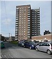
Ladstone Towers, Sowerby Bridge
One of two large tower blocks on this hillside; the other one is Houghton Towers.
Image: © Humphrey Bolton Taken: 5 Mar 2009
0.04 miles
5
Footbridge over the Rochdale Canal
Image: © Alexander P Kapp Taken: 20 Nov 2008
0.04 miles
6
Benchmark on side wall (Tuel Lane face) of #1 Wallis Street
Ordnance Survey cut mark benchmark described on the Bench Mark Database at www.bench-marks.org.uk/bm59783
Image: © Luke Shaw Taken: 29 Jun 2018
0.04 miles
7
Spiritualist Progressive Lyceum - Hollins Hill, Tuel Lane
Image: © Betty Longbottom Taken: 4 Aug 2008
0.05 miles
8
Sowerby Bridge - National Spiritualist Church
On Hollins Lane. For an alternative view, please see Image
Image: © Dave Bevis Taken: 19 Feb 2014
0.05 miles
9
Tower block and terraces in Sowerby Bridge
Ladstone Towers looks as though it was probably built in the 1960s, although I'm not sure what year. In this view, against a rather overcast sky, the tower block looms above the Victorian terraces of Dale Terrace and Orion Place below. Viewed from the Rochdale Canal next to Corporation Mill.
Image: © Bobby Clegg Taken: 4 Sep 2015
0.05 miles
10
Benchmark on #36 Industrial Road
Image: © Luke Shaw Taken: 29 Jun 2018
0.05 miles
  • ...