IMAGES TAKEN NEAR TO
Kingstone, HEREFORD, HR2 9ES

Introduction

This page details the photographs taken nearby to HR2 9ES by members of the Geograph project.

The Geograph project started in 2005 with the aim of publishing, organising and preserving representative images for every square kilometre of Great Britain, Ireland and the Isle of Man.

There are currently over 7.5m images from over14,400 individuals and you can help contribute to the project by visiting https://www.geograph.org.uk

Image Map


Images are licensed for reuse under creativecommons.org/licenses/by-sa/2.0
Notes
  • Clicking on the map will re-center to the selected point.
  • The higher the marker number, the further away the image location is from the centre of the postcode.

Image Listing (30 Images Found)

Images are licensed for reuse under creativecommons.org/licenses/by-sa/2.0
  • ...
Image
Details
Distance
1
Children's play area, Kingstone
The large notice on the left states that this is a children's play area and sports field, not a dog toilet.
Image: © Jaggery Taken: 26 Aug 2012
0.02 miles
2
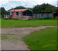
Recreation ground pavilions, Kingstone
Seven Site Recreation Ground is owned and maintained by Kingstone Sports Association for the people of Kingstone and Thruxton.
Image: © Jaggery Taken: 26 Aug 2012
0.06 miles
3
Cotton's Meadow
A 1990's cul-de-sac on the north edge of Kingstone.
Image: © Jonathan Billinger Taken: 31 Jul 2008
0.08 miles
4
Woodfield Close, Kingstone
Modern housing contrasts with a nearby 17th century half-timbered cottage. http://www.geograph.org.uk/photo/3641994
Image: © Jaggery Taken: 26 Aug 2012
0.09 miles
5
Waste ground north of Kingstone
Ripe for development when the economy picks up.
Image: © Jonathan Billinger Taken: 31 Jul 2008
0.11 miles
6
Lilac Cottage, Kingstone
A 17th century half-timbered cottage in a village with mostly modern housing.
Image: © Jaggery Taken: 26 Aug 2012
0.11 miles
7
Cottage in Kingstone
Picturesque half-timbered cottage in Kingstone.
Image: © Philip Halling Taken: 18 Sep 2010
0.14 miles
8
Modern houses in Kingstone
1970s style houses on White House Drive in Kingstone.
Image: © Philip Halling Taken: 18 Sep 2010
0.16 miles
9
Kingstone Old School
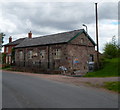
A florid inscription on the building shows that it was erected in 1845 as Kingstone and Thruxton National School. The school opened in 1846, was enlarged in 1889 and eventually closed in 1952, when children were transferred to makeshift buildings a mile away. The old school is now used as a scout hut and church hall. It was refurbished in 1990/1991 by the joint committee of Kingstone Scout Group and Dore District Venture Scouts.
Image: © Jaggery Taken: 26 Aug 2012
0.17 miles
10
Kingstone old school
Built in 1837 as the original school for Kingstone and Thruxton, now used by the local scouts.
Image: © Jonathan Billinger Taken: 31 Jul 2008
0.20 miles
  • ...