IMAGES TAKEN NEAR TO
MIDHURST, GU29 9QJ
Introduction
This page details the photographs taken nearby to GU29 9QJ by members of the Geograph project.
The Geograph project started in 2005 with the aim of publishing, organising and preserving representative images for every square kilometre of Great Britain, Ireland and the Isle of Man.

There are currently over 7.5m images from over14,400 individuals and you can help contribute to the project by visiting https://www.geograph.org.uk
Image Map (Loading...)


Getting Data...Please wait
Leaflet Map data © OpenStreetMap
Images are licensed for reuse under creativecommons.org/licenses/by-sa/2.0
Notes
- Clicking on the map will re-center to the selected point.
- The higher the marker number, the further away the image location is from the centre of the postcode.
Image Listing (14 Images Found)
Images are licensed for reuse under creativecommons.org/licenses/by-sa/2.0
Image
Details
Distance
1
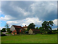
Disused farm equipment
Near Brickyard Cottages.
Image: © Robin Webster
Taken: 31 Aug 2012
0.06 miles
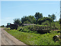
3
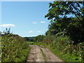
Farm track south from Lower Barn
Not a public route.
Image: © Robin Webster
Taken: 31 Aug 2012
0.09 miles
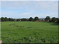
4
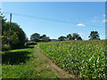
Field edge near Lower Barn
A field of maize.
Image: © Robin Webster
Taken: 31 Aug 2012
0.10 miles
5
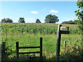
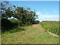
Footpath corner by Lower Barn
A path towards Bepton Common.
Image: © Robin Webster
Taken: 31 Aug 2012
0.12 miles
6
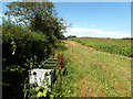
Cattle trough in field of maize
Over the hedge is a track mapped as Pitsham Lane (path). It is a public footpath at the far end, but here the public route follows the east side of this field, not the west.
Image: © Robin Webster
Taken: 31 Aug 2012
0.12 miles
7
Field edge near Lower Barn
A field of maize.
Image: © Robin Webster
Taken: 31 Aug 2012
0.12 miles
8
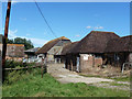
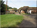
Farmyard, Lower Barn
No house on the site, although Brickyard Cottages are not far away.
Image: © Robin Webster
Taken: 31 Aug 2012
0.13 miles