1
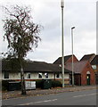
Stroud Road electricity substation, Gloucester
The Western Power Distribution electricity substation identifier is STROUD RD S/S 4550.
A warning on the substation shows the presence of SF6 (sulphur hexafluoride, an insulating gas used in high voltage systems).
Image: © Jaggery
Taken: 6 Nov 2016
0.01 miles
2
Stroud Road telecoms mast and cabinets, Gloucester
Located outside Rosebank Surgery. An electricity substation http://www.geograph.org.uk/photo/5185608 is on the right.
Image: © Jaggery
Taken: 6 Nov 2016
0.02 miles
3
Ordnance Survey Cut Mark
This OS cut mark can be found on No8 Goodwin Court. It marks a point 19.030m above mean sea level.
Image: © Adrian Dust
Taken: 9 Jul 2022
0.02 miles
4
Rosebank Surgery and Lloyds Pharmacy, Gloucester
Viewed across the B4072 Stroud Road.
Image: © Jaggery
Taken: 6 Nov 2016
0.02 miles
5
Corner of Stanley Terrace and Robinson Road, Gloucester
Stanley Terrace is on the left.
Image: © Jaggery
Taken: 6 Nov 2016
0.03 miles
6
Northern end of Stanley Terrace, Gloucester
The 30mph speed limit on Stroud Road drops to 20mph on Stanley Terrace.
Image: © Jaggery
Taken: 6 Nov 2016
0.03 miles
7
Thomas Nelson Foster Memorial
This memorial was erected by public subscription at a cost of £250. The inscription reads:
'In memory of Thomas Nelson Foster, J.P., Christian, Citizen and Merchant, who died at sea 2nd October 1901'.
When it was unveiled in 1902 it also included a drinking fountain and had electric lights on the corners. Thomas Nelson Foster was the owner of Foster Brothers, an oil mill at Baker's Quay in the Docks. Originally the company was based in Evesham but relocated in 1863. Among the goods handled were linseed which was imported from Russia, Argentina and India, and cotton seed from Egypt.
Foster Brothers employed 129 workers in 1897, and amalgamated with other firms in 1899 to form British Oil and Cake Mills Limited. Information sourced from: http://www.geograph.org.uk/submit2.php#gridref=SO8317
Image: © Philip Halling
Taken: 26 Feb 2011
0.04 miles
8
East along Robinson Road, Gloucester
From King Edward's Avenue along Robinson Road towards Stroud Road.
Image: © Jaggery
Taken: 6 Nov 2016
0.04 miles
9
Detail of the Thomas Nelson Foster Memorial
Image: © Philip Halling
Taken: 26 Feb 2011
0.06 miles
10
Stroud Road Pharmacy, Gloucester
At 153A Stroud Road, near Rosebank medical surgery.
Image: © Jaggery
Taken: 6 Nov 2016
0.07 miles


