1
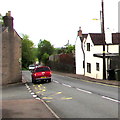
Zigzag markings on Bream Road, Lydney
The yellow markings define the Keep Clear Zone outside Lydney Church of England Primary School.
Image: © Jaggery
Taken: 22 May 2016
0.02 miles
2
Keep Clear Zone, Bream Road, Lydney
Near Lydney Church of England Primary School. http://www.geograph.org.uk/photo/5035400
Image: © Jaggery
Taken: 22 May 2016
0.02 miles
3
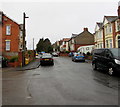
Down Grove Road, Lydney
Grove Road descends towards the centre of Lydney past
Lydney & District Hospital buildings on both sides of the road.
Image: © Jaggery
Taken: 22 May 2016
0.03 miles
4
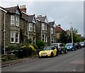
Change of house type, Grove Road, Lydney
Houses on the west side of the road.
Image: © Jaggery
Taken: 22 May 2016
0.03 miles
5
Warning sign - school, Bream Road, Lydney
On the descent towards Lydney Church of England Primary School. http://www.geograph.org.uk/photo/5035400
Image: © Jaggery
Taken: 22 May 2016
0.03 miles
6
Keep the Zigzags Clear notice, Bream Road, Lydney
The notice on the left refers to the Keep Clear Zone outside Lydney Church of England Primary School.
The left turn is the school entrance. http://www.geograph.org.uk/photo/5035587
Image: © Jaggery
Taken: 22 May 2016
0.03 miles
7
NW along Grove Road, Lydney
Looking to the northwest along Grove Road from the corner of Stanford Road.
Image: © Jaggery
Taken: 5 Jan 2020
0.04 miles
8
Entrance to Lydney Church of England Primary School
From the B4231 Bream Road in Lydney.
Image: © Jaggery
Taken: 22 May 2016
0.04 miles
9
Banners on school railings, Lydney
On the Bream Road side of Lydney Church of England Primary School.
Image: © Jaggery
Taken: 22 May 2016
0.05 miles
10
Newly-built house, Grove Road, Lydney
Still fenced off on May 22nd 2016.
A July 2009 Google Earth Street View shows no house here, only a wooden fence.
Image: © Jaggery
Taken: 22 May 2016
0.05 miles


