1
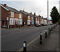
Tredworth Road houses, Gloucester
The corner of Conduit Street http://www.geograph.org.uk/photo/5184834 is on the left.
Image: © Jaggery
Taken: 6 Nov 2016
0.03 miles
2
Conduit Street, Tredworth, Gloucester
Looking north across Tredworth Road.
Image: © Jaggery
Taken: 6 Nov 2016
0.04 miles
3
Corner of Furlong Road and Tredworth Road, Gloucester
Viewed across Tredworth Road near the corner of Stroud Road.
Image: © Jaggery
Taken: 6 Nov 2016
0.07 miles
4
Furlong Road, Gloucester
The 30mph speed limit on Tredworth Road drops to 20 on Furlong Road.
Image: © Jaggery
Taken: 6 Nov 2016
0.09 miles
5
Former Toll House, Stroud Road
At the junction with Tredworth Road. Believed to be a much modified ex Toll House, not much is obvious of the original building, though the footprint is very similar to that shown on the 1882/3 map. It would have served the Gloucester and Stroud Turnpike Trust up to the mid 19ᵗʰ Century.
Milestone Society National ID: GL.GLO02
Image: © Mr Red
Taken: 16 Dec 2022
0.09 miles
6
Stroud Road Pharmacy, Gloucester
At 153A Stroud Road, near Rosebank medical surgery.
Image: © Jaggery
Taken: 6 Nov 2016
0.09 miles
7
Victorian pillarbox, Stroud Road, Gloucester
Located here. http://www.geograph.org.uk/photo/5185039
Image: © Jaggery
Taken: 6 Nov 2016
0.10 miles
8
Stroud Road pillarbox and BT phonebox, Gloucester
Located near the corner of Tredworth Road. The pillarbox is Victorian. http://www.geograph.org.uk/photo/5185043
Image: © Jaggery
Taken: 6 Nov 2016
0.10 miles
9
JCDecaux advertising hoardings, Stroud Road, Gloucester
Numbered 008101 and 008102, the hoardings are on the east side of the B4072 Stroud Road.
JCDecaux is the largest outdoor advertising corporation in the world.
A Victorian pillarbox http://www.geograph.org.uk/photo/5185043 is on the left.
Image: © Jaggery
Taken: 6 Nov 2016
0.10 miles
10
Rosebank Surgery and Lloyds Pharmacy, Gloucester
Viewed across the B4072 Stroud Road.
Image: © Jaggery
Taken: 6 Nov 2016
0.11 miles


