1
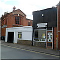
Duberley butchers, Gloucester
Premises of C.Duberley, 71 Alvin Street, facing Worcester Parade. http://www.geograph.org.uk/photo/2880117
Image: © Jaggery
Taken: 2 Apr 2012
0.01 miles
2
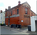
69 Alvin Street, Gloucester
Shop and warehouse built in 1885 as the Gloucester Co-operative Society’s Branch No 2.
Above the window nearest the camera is
GLOUCESTER CO-OPERATIVE SOCIETY LIMITED
Below the window is
BRANCH No 2 1885.
Image: © Jaggery
Taken: 2 Apr 2012
0.01 miles
3
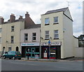
Belles Barber Shop, Gloucester
On the corner of Worcester Street and St Catherine Street.
Its neighbour is Simply Beautiful, beauty and tanning salon.
Image: © Jaggery
Taken: 2 Apr 2012
0.01 miles
4
Worcester Street railway bridge, Gloucester
There is a benchmark http://www.geograph.org.uk/photo/6091303 on the right hand abutment.
Image: © Alan Murray-Rust
Taken: 16 Mar 2019
0.02 miles
5
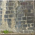
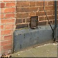
Bench mark, Worcester Street railway bridge
See http://www.geograph.org.uk/photo/6091305 for location.
Image: © Alan Murray-Rust
Taken: 16 Mar 2019
0.02 miles
6
Part of a billboard poster
Image: © Nick Mutton 01329 000000
Taken: 24 Jun 2010
0.03 miles
7
Park Street Mission Room
Image: © Nick Mutton 01329 000000
Taken: 24 Jun 2010
0.03 miles
8
25, 27 and 29, Worcester Street, Gloucester
Terrace of three houses. c1825, with late C19 and C20 alterations, Listed Grade II.
There is a benchmark http://www.geograph.org.uk/photo/6091310 on the left hand edge of no.25.
Image: © Alan Murray-Rust
Taken: 16 Mar 2019
0.03 miles
9
Ordnance Survey Cut Mark
This OS cut mark can be found on the east buttress of the railway bridge on Worcester Street. It marks a point 13.164m above mean sea level.
Image: © Adrian Dust
Taken: 9 Jul 2022
0.03 miles
10
Bench mark, 25 Worcester Street, Gloucester
See http://www.geograph.org.uk/photo/6091312 for location.
Image: © Alan Murray-Rust
Taken: 16 Mar 2019
0.04 miles


