1
Ivy Grove, Stonehouse
Part of Wycliffe College, set back from entrance gate 8.
Originally a detached house dating from the 17th century, with 19th century alterations.
Grade II listed in 1960.
Image: © Jaggery
Taken: 13 Dec 2017
0.03 miles
2
Wycliffe College Chapel, Stonehouse
Image: © Philip Halling
Taken: 18 Oct 2014
0.04 miles
3
Joseph Martin hairdressing, Stonehouse
At 54 Bath Road, on the corner of Pearcroft Road.
Image: © Jaggery
Taken: 3 Apr 2016
0.04 miles
4
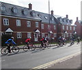
Sunday morning cyclists in Stonehouse
Cycling out of Stonehouse on the B4008 Bath Road.
Image: © Jaggery
Taken: 3 Apr 2016
0.05 miles
5
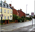
Start of the 20 zone, Bath Road, Stonehouse
The 30mph speed limit on the B4008 Bath Road drops to 20mph.
Image: © Jaggery
Taken: 7 May 2017
0.05 miles
6
From 20 to 30, Bath Road Stonehouse
The 20mph zone in the centre of Stonehouse ends here.
Image: © Jaggery
Taken: 13 Dec 2017
0.05 miles
7
Bethel Church, Stonehouse
From Burdett Road.
Image: © Eirian Evans
Taken: 2 May 2011
0.05 miles
8
Wycliffe College Chapel Spire, Stonehouse
Viewed across Bath Road. The tower and spire were Grade II listed in 1987.
The Grade II listing does not include the attached chapel building.
Image: © Jaggery
Taken: 28 Dec 2014
0.05 miles
9
Wycliffe College Chapel, Stonehouse
Viewed across Bath Road from the corner of Burdett Road. A Stonehouse History Group information board records that in its early days, Wycliffe was closely linked to the Methodist church in Stonehouse which at that time met in an iron chapel at Ryeford. Land next to Ivy Grove was used in 1911 to build a chapel to be shared by the school and the Methodists.
The clock tower and spire were added in 1921 as a memorial to the 77 Old Wycliffians who died in the Great War (now usually known as the First World War). In 1939 the chapel was transferred from the Methodist church to the school.
Image: © Jaggery
Taken: 13 Dec 2017
0.05 miles
10
Wycliffe College chapel
Wycliffe College is a public school in the town and has a large number of buildings scattered about. This is the impressive chapel with a fine spire built in 1921.
Image: © Neil Owen
Taken: 7 Feb 2023
0.05 miles


