1
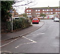
Elm Road flats, Stonehouse
The flats are at the western end of Elm Road. Viewed across Park Road.
Image: © Jaggery
Taken: 20 Nov 2011
0.02 miles
2
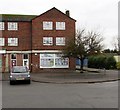
Methodist church and hall, Stonehouse
Elm Road side of Douglas Morley Hall and Stonehouse Methodist Church, on the corner of Park Road.
The church is in the Gloucestershire Methodist Circuit, part of the Bristol District of the Methodist Church.
Image: © Jaggery
Taken: 13 Dec 2015
0.02 miles
3
Douglas Morley Hall, Stonehouse Methodist Church
The hall is on the Elm Road side of the church. http://www.geograph.org.uk/photo/3269126 to a view of the Park Road side of the church.
The hall is used by local clubs and for a variety of community activities. A few examples are Short Mat Bowling Club, community learning sessions and the Stonehouse Wednesday Fellowship.
Image: © Jaggery
Taken: 20 Nov 2011
0.03 miles
4
Elm Road bus stop, Stonehouse
The bus stop sign on the pole shows (bus route) 61. Park Parade Shops are in the background.
Image: © Jaggery
Taken: 13 Dec 2015
0.03 miles
5
Stonehouse Methodist Church
Viewed across Park Road. The church, located on the corner of Elm Road, is in the Gloucestershire Methodist Circuit, part of the Bristol District of the Methodist Church.
Image: © Jaggery
Taken: 20 Nov 2011
0.03 miles
6
All Pulling Together, Stonehouse
Community Association located at the northern end of Park Parade Shops, Park Road.
Image: © Jaggery
Taken: 13 Dec 2015
0.03 miles
7
Dead-end part of Park Road, Stonehouse
The dead-end road extends for 50 metres from the east side of Park Road.
Image: © Jaggery
Taken: 22 Apr 2018
0.03 miles
8
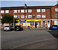
Spar, Park Parade Shops, Stonehouse
Spar store viewed across Park Road in mid December 2015.
An August 2010 Google Earth Street View shows a Londis store here.
Image: © Jaggery
Taken: 13 Dec 2015
0.04 miles
9
Premier convenience store, Park Parade Shops, Stonehouse
Viewed across Park Road in April 2018. A Spar was here in December 2015. http://www.geograph.org.uk/photo/4764669
Image: © Jaggery
Taken: 22 Apr 2018
0.04 miles
10
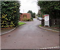
Entrance to The Elms, Stonehouse
Set back from Elm Road, The Elms is an Orders of St John Care Trust care home (with nursing).
There are 45 single rooms for residents, who must be at least 65 years old.
Image: © Jaggery
Taken: 13 Dec 2015
0.04 miles


