IMAGES TAKEN NEAR TO
Creityhall Drive, GLASGOW, G63 0JD

Introduction

This page details the photographs taken nearby to Creityhall Drive, G63 0JD by members of the Geograph project.

The Geograph project started in 2005 with the aim of publishing, organising and preserving representative images for every square kilometre of Great Britain, Ireland and the Isle of Man.

There are currently over 7.5m images from over14,400 individuals and you can help contribute to the project by visiting https://www.geograph.org.uk

Image Map


Images are licensed for reuse under creativecommons.org/licenses/by-sa/2.0
Notes
  • Clicking on the map will re-center to the selected point.
  • The higher the marker number, the further away the image location is from the centre of the postcode.

Image Listing (23 Images Found)

Images are licensed for reuse under creativecommons.org/licenses/by-sa/2.0
  • ...
Image
Details
Distance
1
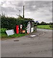
Busy corner
Bus service, postal service and telecom service at the corner of Creityhall Road and B837
Image: © Jim Smillie Taken: 5 Sep 2020
0.07 miles
2
Bus shelter and postbox, Milton of Buchanan
Image: © Alpin Stewart Taken: 17 Mar 2017
0.07 miles
3
Approaching Milton of Buchanan
Image: © John Firth Taken: 15 Apr 2015
0.08 miles
4
Creityhall Road leaving Milton of Buchanan
Looking north-eastward. This section of road is used by the West Highland Way Path.
Image: © Peter Wood Taken: 9 Sep 2022
0.09 miles
5
Milton of Buchanan
Image: © Chris Upson Taken: 8 Apr 2006
0.09 miles
6
The old mill at Milton of Buchanan
Image: © Elliott Simpson Taken: 17 May 2008
0.13 miles
7
Looking east at Milton of Buchanan
This lovely little village sits on the B837 to the east of Loch Lomond.
Image: © James Denham Taken: 16 Sep 2014
0.13 miles
8
Milton of Buchanan
Housing at the east end of Milton of Buchanan,the main road is the b837.
Image: © edward mcmaihin Taken: 19 Oct 2010
0.14 miles
9
Former watermill at Milton of Buchanan
The mill wheel was driven by water fed through an underground channel from a mill pond on raised ground just to the NW of the mill. To the SW side of the wheel was a timber-built sawmill forming which was demolished when the mill was converted to a dwelling. It is listed Category C.
Image: © Eirian Evans Taken: 8 Sep 2021
0.15 miles
10
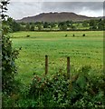
View to Conic Hill
From Creityhall Road
Image: © Jim Smillie Taken: 5 Sep 2020
0.16 miles
  • ...