1
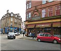
Port Street, Stirling
Image: © Richard Webb
Taken: 3 May 2022
0.01 miles
2
Port Street, Stirling
Looking north.
Image: © Andrew Abbott
Taken: 18 Aug 2020
0.02 miles
3
58-70 Port Street, Stirling
Ebenezer Simpson, 1900 - 4-storey tenement including shops to ground floor, 8-bay with pressed-in canted windows to outer-bays, paired to central section. Red sandstone ashlar to principal (SE) elevation; brick to plain rear elevation; rubble to SW gable, pitched slate roof, large ashlar gable end and ridge stacks (that to SW rendered). Principal elevation ornamented by stonework detail including pedimented strip pilasters, moulded window surrounds, cartouches, corniced cill, string and eaves courses, surmounted by balustrade, gabled wallhead to centre, this and outer-bays capped by shaped broken pediment with flanking miniature obelisks. Modern shopfronts; 2 original pedimented close doors flanking central shop providing access to flats. Some original plate glass timber sash and case windows remaining.
A dominant wide-fronted tenement with an array of decorated detailing contributing significantly to the streetscape of Port Street. Although stylistically very different from its immediate neighbour at 52-56 Port Street (see separate listing), both buildings are in fact by the same local architect - E Simpson - and were built within a year of each other (58-70 being the earlier of the two). Simpson visually links both buildings by employing the motif of strip pilasters to each. The Dean of Guild plans and the Ordnance Survey Maps and Valuation Rolls indicate that the building was designed and built with a large tenement block to the rear, creating an overall T-plan. The tenement block to the rear was made up of 24 flats and was named the Alexandra Buildings. Although both tenement blocks stood separately with no internal communication, they were physically joined by a central rear outshot at basement and ground floor (this outshot remains although heavily modernised).
Grade B listed. Listing number LB49599.
Image: © Andrew Abbott
Taken: 18 Aug 2020
0.02 miles
4
Port Customs Bar
59-61 Port Street and 1-3 Upper Craggs, Stirling.
Image: © Andrew Abbott
Taken: 18 Aug 2020
0.03 miles
5
Corner of Dumbarton Road and Port Street
On the far corner is the Blue Lagoon fish and chip shop. It is one branch of a franchise started in Glasgow in 1975 http://web.archive.org/web/20171005105440/https://bluelagoonfishandchips.co.uk/our-story/ The Stirling branch opened in 2016 in what had previously been The Porters bar.
On the near corner is the Filling Station, an American bar and restaurant https://www.filling-stations.co.uk/restaurants/scotland/stirling/stirling
It has an unusual inscription on the wall.
Image: © Gerald England
Taken: 22 Mar 2017
0.03 miles
6
Filling Station
Now occupied on the ground floor as an American bar and restaurant, the building is Category C listed http://portal.historicenvironment.scot/designation/LB41426 and dates from 1897. On the Dumbarton Road wall is a curious carving of a wolf and an inscription
Image
Image: © Gerald England
Taken: 22 Mar 2017
0.03 miles
7
42 Port Street and 1-5 Dumbarton Road, Stirling
John Allan, dated 1897. Curious free-style manner, 4-storey and attic, ground floor shops, 4-window centre between bays with shaped gables on Dumbarton Road, oriel bay on Port Street, 4-window quadrant corner surmounted by timber and lead cupola feature of original ringed, funnel-shaped outline, slated mansard roof, arched dormers.
Grade C listed. Listing number LB41426.
Image: © Andrew Abbott
Taken: 18 Aug 2020
0.03 miles
8
Mr Simms Olde Sweet Shoppe
At the top of Port Street.
Image: © Gerald England
Taken: 22 Mar 2017
0.03 miles
9
80 Port Street, Stirling
Late 18th century, 2-storey and attic, 4-window painted ashlar, moulded doorpiece with elegant frieze over centre, pediment and angle urns; main cornice, 2 canted dormers. Slated roof.
Grade B listed. Listing number LB41427.
Image: © Andrew Abbott
Taken: 18 Aug 2020
0.03 miles
10
Carving and inscription above the Filling Station
On the wall of the Filling Station
Image is a thistle above a carving of a wolf and an inscription that reads:
Here in Auld days
The Wolf roam'd
In a hole of the rock
In ambush lay.
It is possibly connected with a local legend that a howling wolf saved the town from a band of marauding Vikings.
Image: © Gerald England
Taken: 22 Mar 2017
0.03 miles


